Information
Names: Versailles
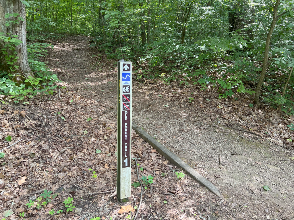
Location: Versailles State Park near Trail 1; before 1943 this was called Versailles Recreational Demonstration Area
County: Ripley (the only one in this county)
Topo quad: Milan
Condition: Not standing; location is pretty clear within a few yards
Maps
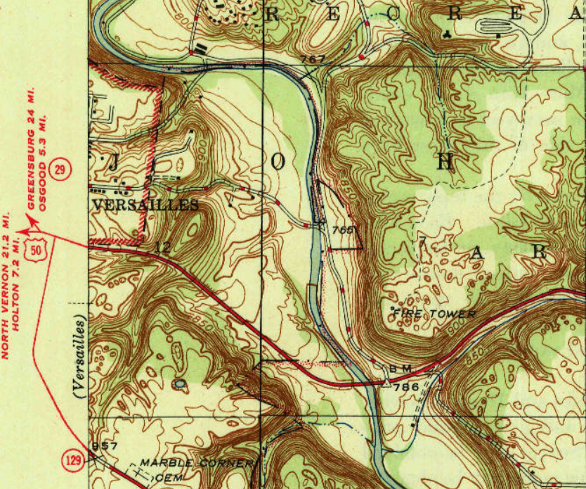
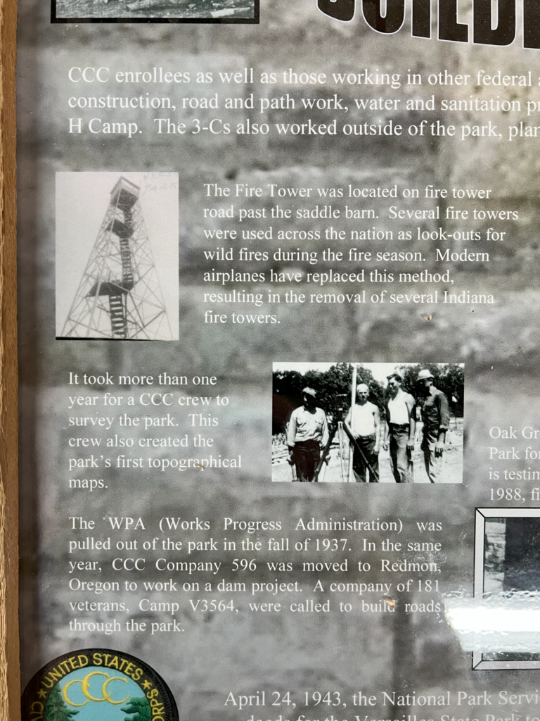
Milan topo quad, 1946, showing the Fire Tower
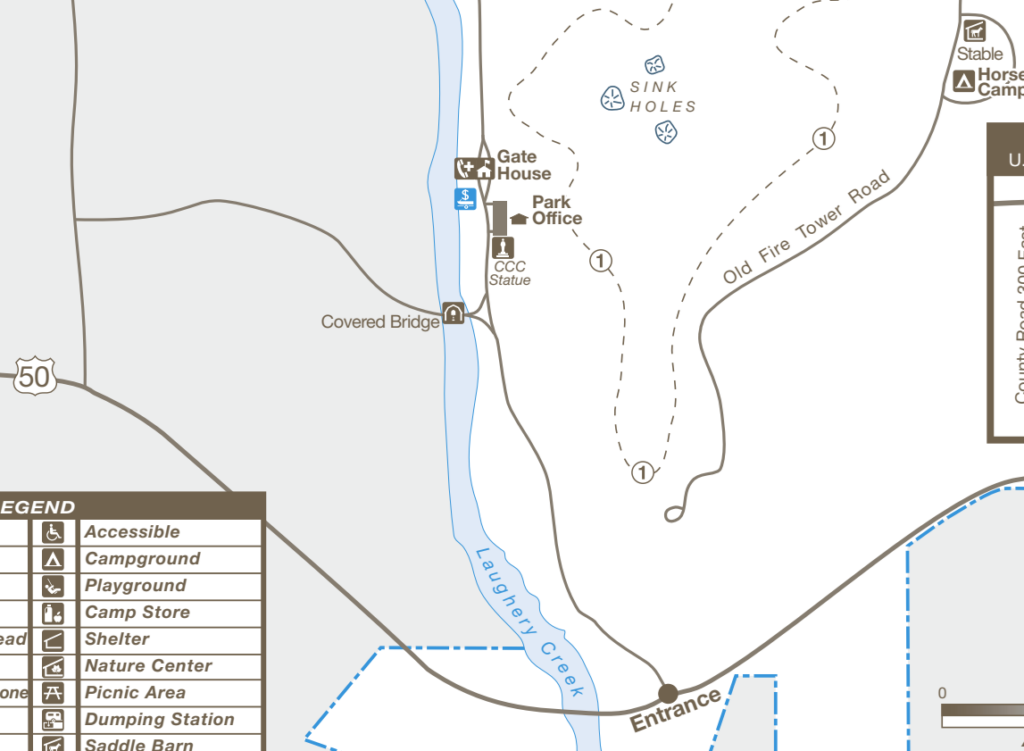
Part of Versailles State Park map showing “Old Fire Tower Road”
Data
Latitude: 39.064242
Longitude: -85.23392
History
This area was acquired by the National Park Service in the 1930s. The property was transferred to the state in 1943 to be used as a state park.
The cultural Map of Ripley County from 1936 does not include a fire tower, which suggests the tower did not exist in 1936.
An article in the September 1980 Outdoor Indiana has a map of Versailles that does not include the fire tower, suggesting perhaps that it was not standing at this time.
A March 1982 OI story about Versailles does not mention the fire tower. The map accompanying the story doesn’t even include the road to the tower.
Online sources say that CCC Company 596 was located at Versailles.
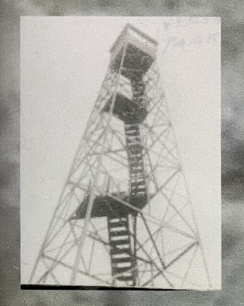
Personal photos and story
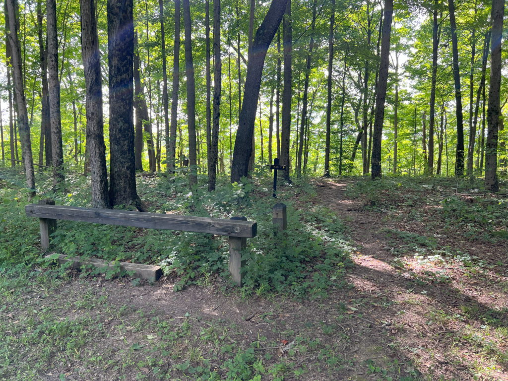
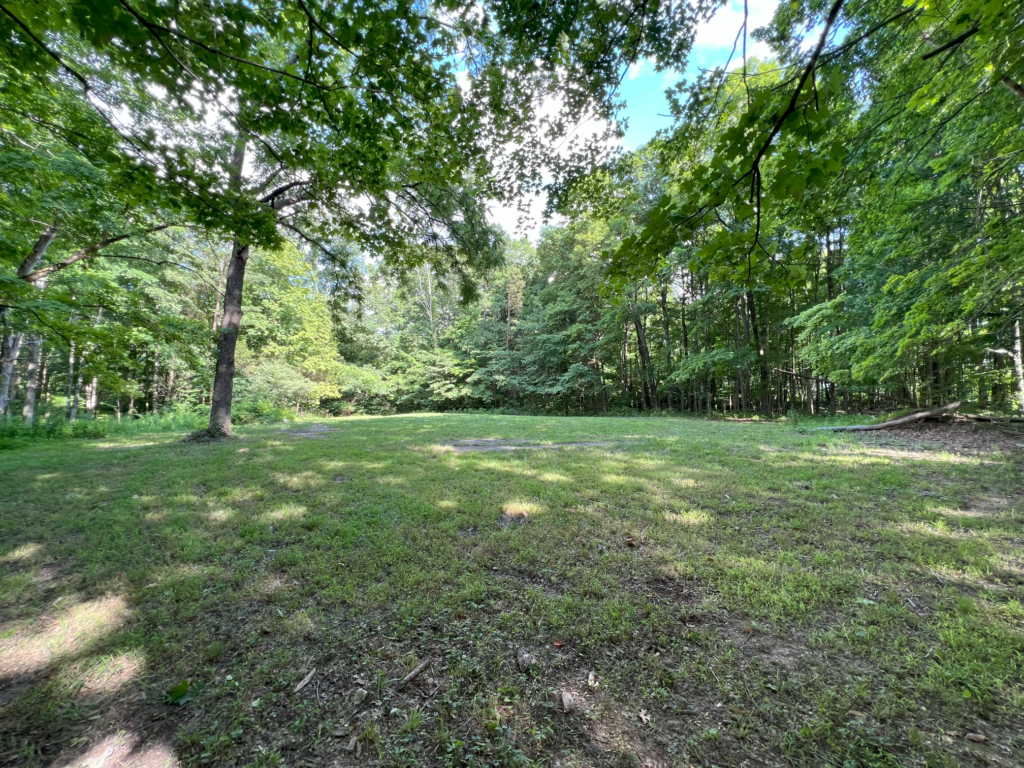
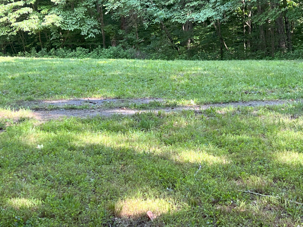
My brother and I visited this site in 2023. You can get here from a side trail from Trail 1. There is also the Old Fire Tower Road but it was gated when we visited, and we just decided to walk the trail instead of the road. The road ends in a loop.
There was concrete debris in the brush just north of the loop that could easily have been part of the base, but not clear if it’s where the base originally was, or just a dumping ground for the debris. It wasn’t immediately obvious if the tower had been inside the circle or just outside.