Information
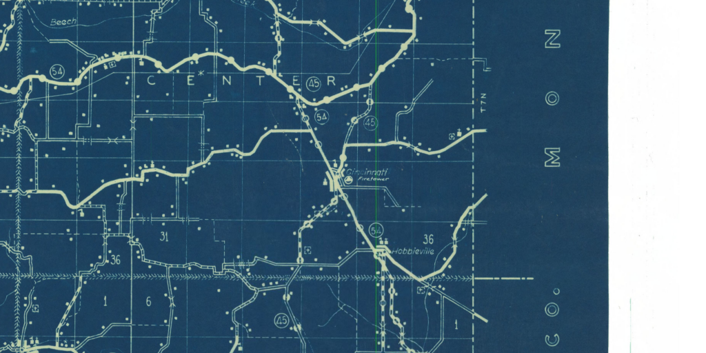
Names: Cincinnati, Little Cincinnati
Location: Private property; southwest of Bloomington Indiana. I’m not sure if it was ever part of a state forest or other state property.
County: Greene (the only tower in this county)
Topo quad: Stanford
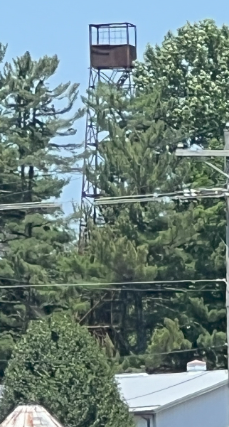
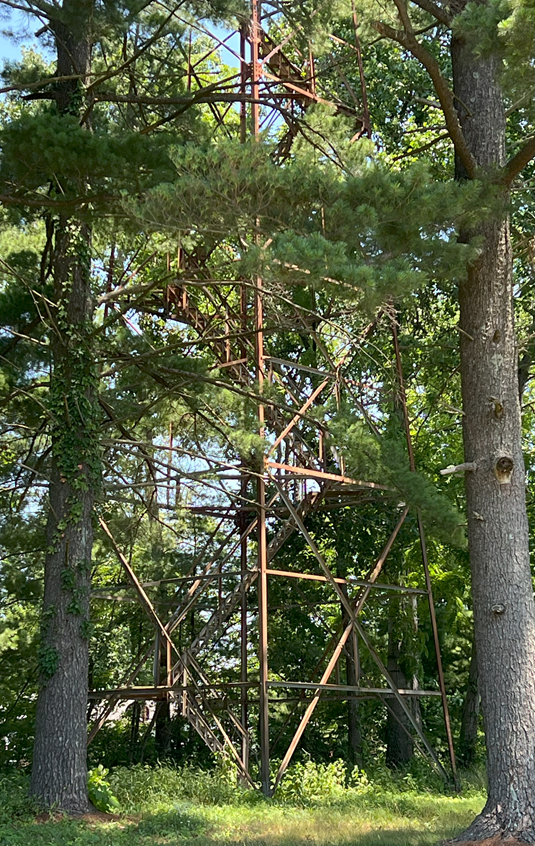
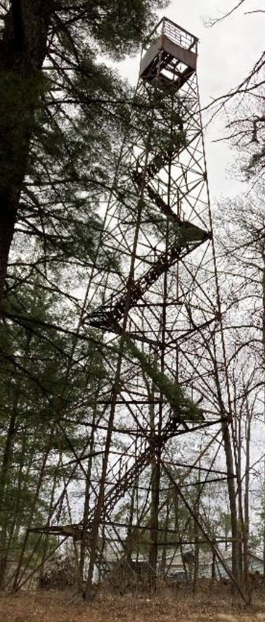
Condition: Standing but the cab is in horrible condition. Not climbable. Not on public land. (Based on our visit to the site area in June 2024.)
Maps
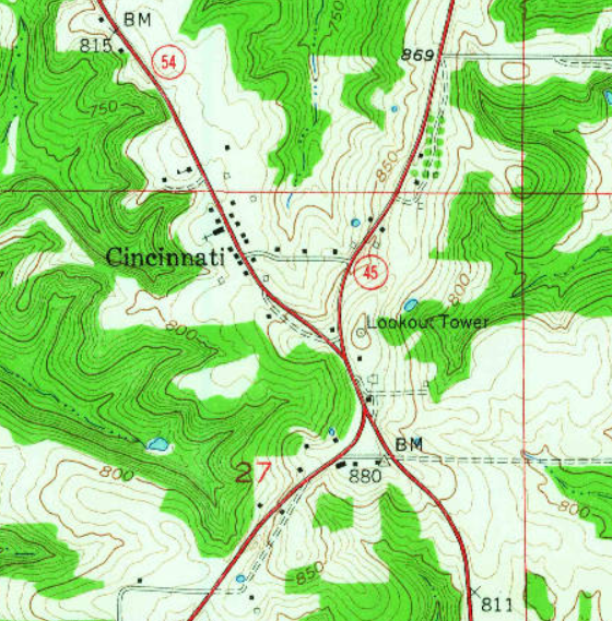
Stanford topo quad, 1956
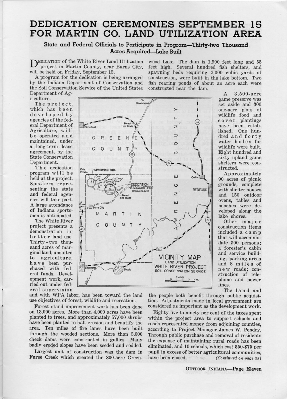
The above article implies that the Cincinnati tower existed in September 1939 when this issue was published.
Links
Teena Ligman has a great story about the Cincinnati tower in this FFLA chapter report from 2022 – with pictures!
Data
| Coordinates | Latitude | Longitude |
| My coordinates (unofficial) | 39.018155 | -86.724901 |
Personal visit and pictures
My brother and I drove to Cincinnati in June 2024. It’s not on public property so we couldn’t get right up to it, but we could see it from a few different directions. From a distance it’s clear that the cab is missing the top and most of the floor, and the whole structure looks rusted.