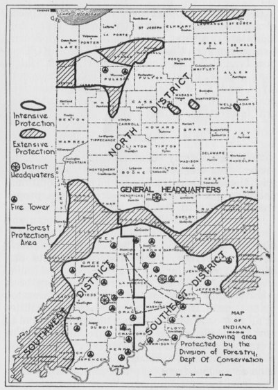
1952 edition
I refer to this as the black-and-white map. I’ve copied this from the Forest Service website’s towers page. My understanding is that this is from 1952 when there were 32 towers.
Some of the towers are marked as “FS” presumably meaning US Forest Service as opposed to state properties. Three towers in Martin County are marked as “N” presumably standing for Naval to refer to the naval ammunition facility at Crane.
I believe the map is saying that these were actual standing towers at the time it was made. (Unlike the colorful map, which includes non-standing ex-towers.)
This map matches the colorful map in the north, with three tower sites. I think the note at the bottom is interesting, saying that the towers in the north were not solely about fire protection.
Note that there is no tower in Morgan county, which is where the Wilbur tower was.
Note that there is no tower in Washington county, where the Salem tower is today. I read that the Borden tower originally in Clark County was moved here. So I’m guessing that this map was made before that tower was moved.
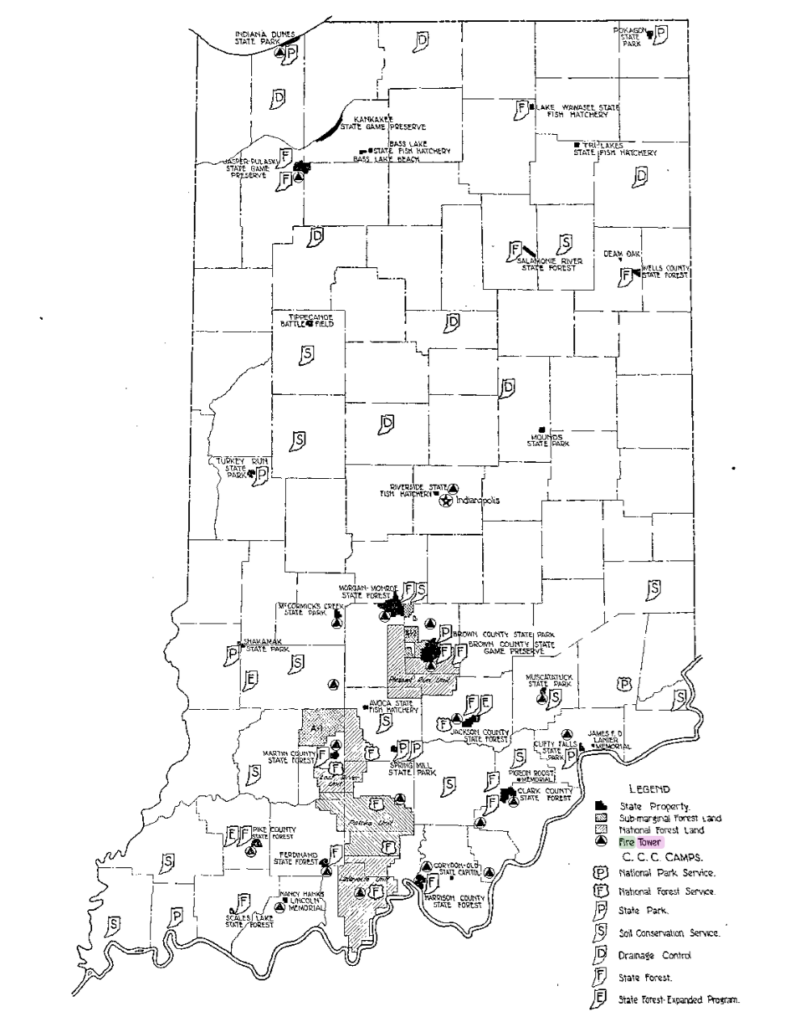
1943 edition
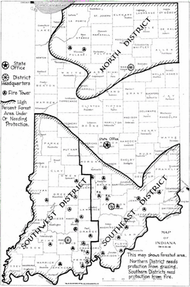
This map is from 1943, taken from this IDNR history of fire in Indiana. Note that only one of the three Crane towers in northern Martin County is visible. Note that the Ouabache tower is not visible in Wells County. The towers in southern Monroe and northern Jackson counties are different than in 1952.
The fire districts are also different than in the later map.
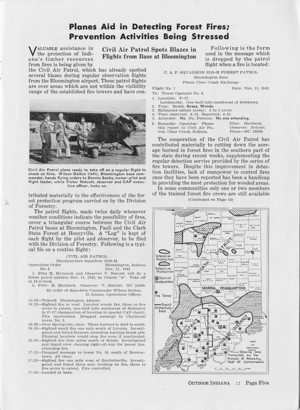
This article from Dec 1942 OI has a map that’s very similar. Here it is in detail:
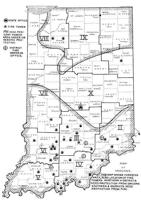
1935 map
The map above is from the 1935 Division of Conservation annual report. There are tower icons that seem to indicate these towers:
- Indiana Dunes
- Jasper-Pulaski
- Indianapolis… the state fair I would guess
- Morgan-Monroe (Mason Ridge)
- McCormick’s Creek
- Greene County in Cincinnati (unlabeled)
- Lilly (unlabeled on this map)
- Brown County State Park / Game Preserve
- Jackson County
- One of the Martin County towers, most likely Willow Valley
- Pike County
- Lincoln
- Ferdinand
- Muscatatuck State Park in Jennings County
- Harrison County State Forest
- Orange County (south of Paoli)
- Clark County State Forest (Henryville)
- Clark County unlabeled… probably Borden
- A tower in Perry County on National Forest land
- Floyd County, east of Corydon (Hickman Hill)
- Jefferson County, northwest of Clifty Falls (Five Points)
There is no tower near Heltonville in Lawrence County on here… the mysterious Salt Creek tower.