Information
Names: Borden
Location: Not known to me as part of any state forest or park; south of current boundaries of Clark State Forest; generally north-northwest of Louisville, KY; in 1966 described as “LOCATED ON STATE OWNED PROPERTY”
County: Clark
Topo quad: Borden
Condition: Not standing at this site; Ron’s site indicates that this tower was moved to the Salem location in Washington County near Salem
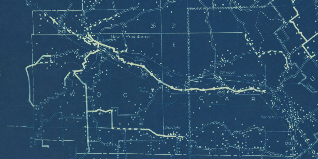
Maps of Borden
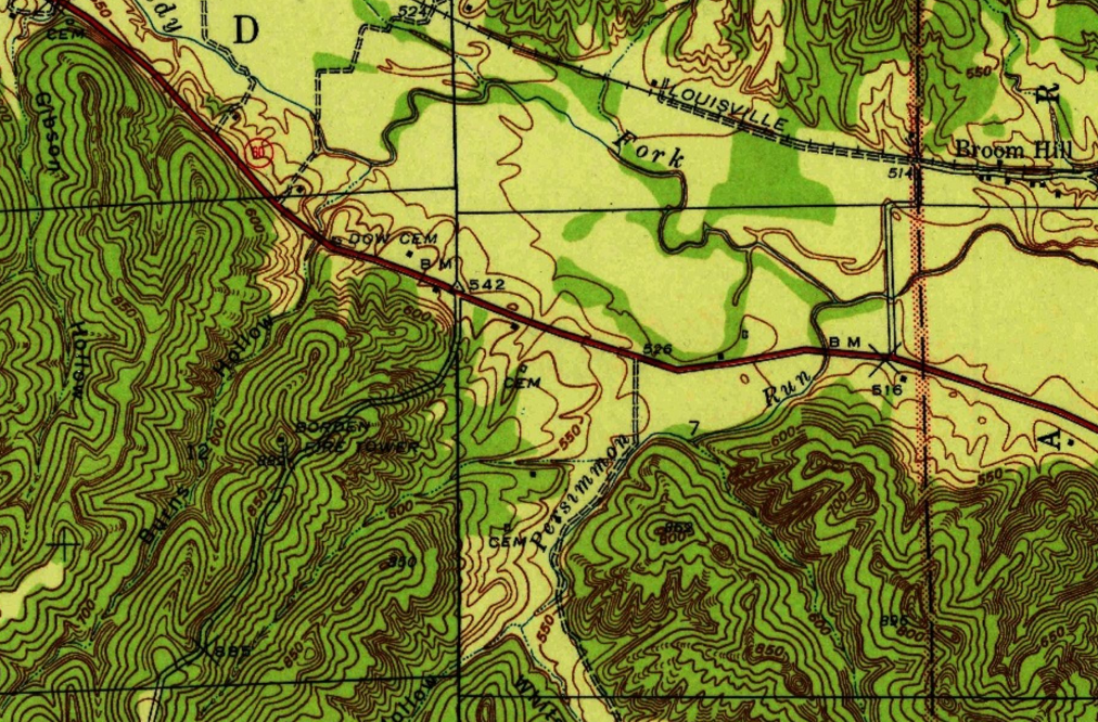
Above: Borden topo quad, 1941
Links about Borden tower site
National Geodetic Survey datasheet for mark BORDEN LOOKOUT TOWER 1947 (HZ2299) – described in 1947 as “THE TOWER IS OF FOUR LEG STEEL TRUSS CONSTRUCTION WITH A CABIN AT THE TOP. IT IS SILVER IN COLOR AND IS ABOUT 85 FEET HIGH.”
NGS datasheet for BORDEN RESET HZ2298 – in 1966 says “THE BORDEN LOOKOUT TOWER MENTIONED IN THE ORIGINAL DESCRIPTION HAS BEEN TORN DOWN AND ONLY THE FOOTINGS REMAIN” and in 1973 mentions “TORN DOWN LOOKOUT TOWER”
Ron’s page about Borden with info about the tower’s move to Salem
Data
| Coordinates | Latitude | Longitude |
| My coordinates (unofficial) | 38.440489 | -85.908496 |
| NGS datasheet for HZ2299 (Google Maps) | 38 26 27.13657(N) | 085 54 29.95608(W) |
| NGS datasheet for HZ2298 (Google Maps) | 38 26 26.60147(N) | 085 54 29.81716(W) |
History of Borden tower
The Borden tower is mentioned in the Division of Conservation’s annual report of 1937, in a list of Fire Warden Personnel, implying that the tower was standing at the time of this list: July 1937.
Ron Kemnow’s research indicates that this Borden tower was moved to Washington County, to the current Salem site. The Washington County Fire Tower Site was started to be mentioned in the annual report of 1948.
The 1957 version of the Borden topo does not show the tower, only the Borden survey mark, implying that the tower is gone.