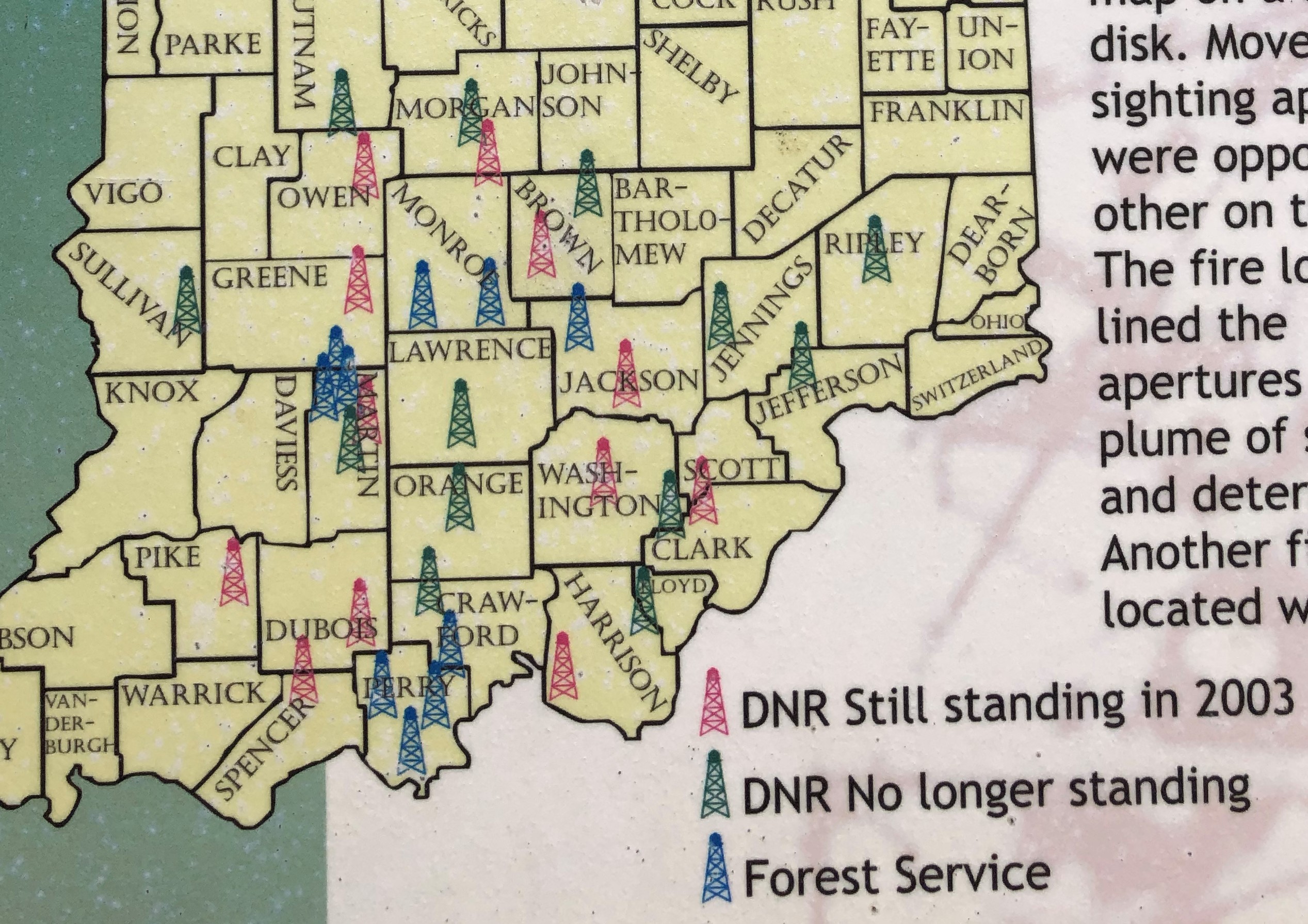
I call this the colorful map, because it depicts the towers in red, blue, and green. One sees this map on physical signs near the bases of most of the standing fire towers in the state parks.
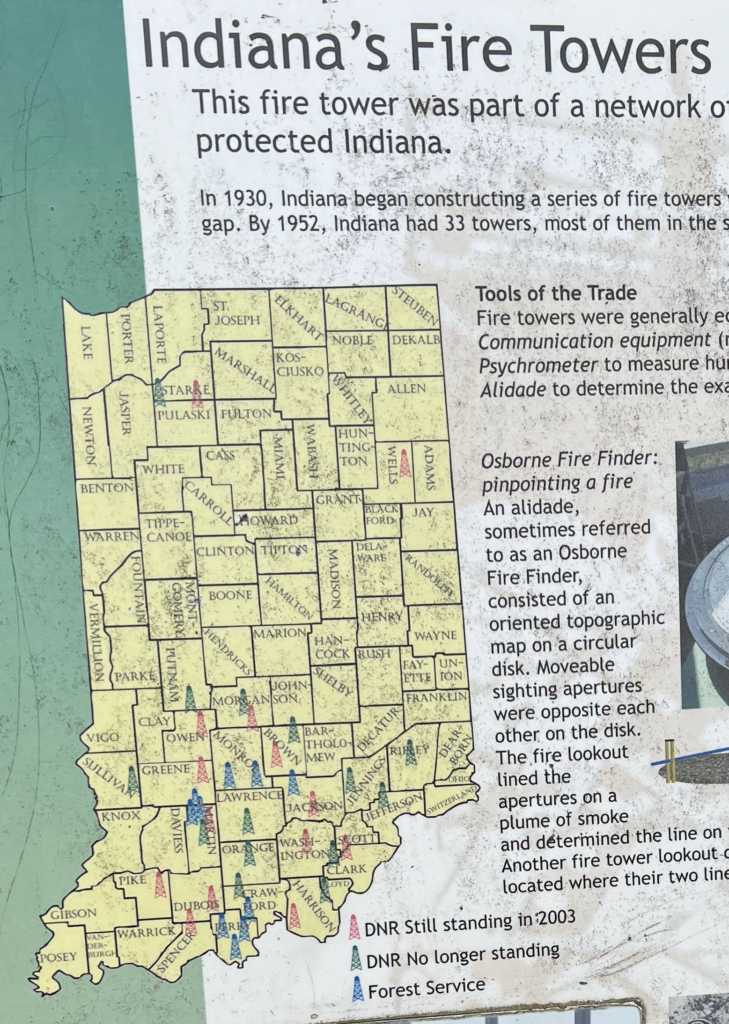
This sign is a lot of what prompted me to start digging into this whole topic.
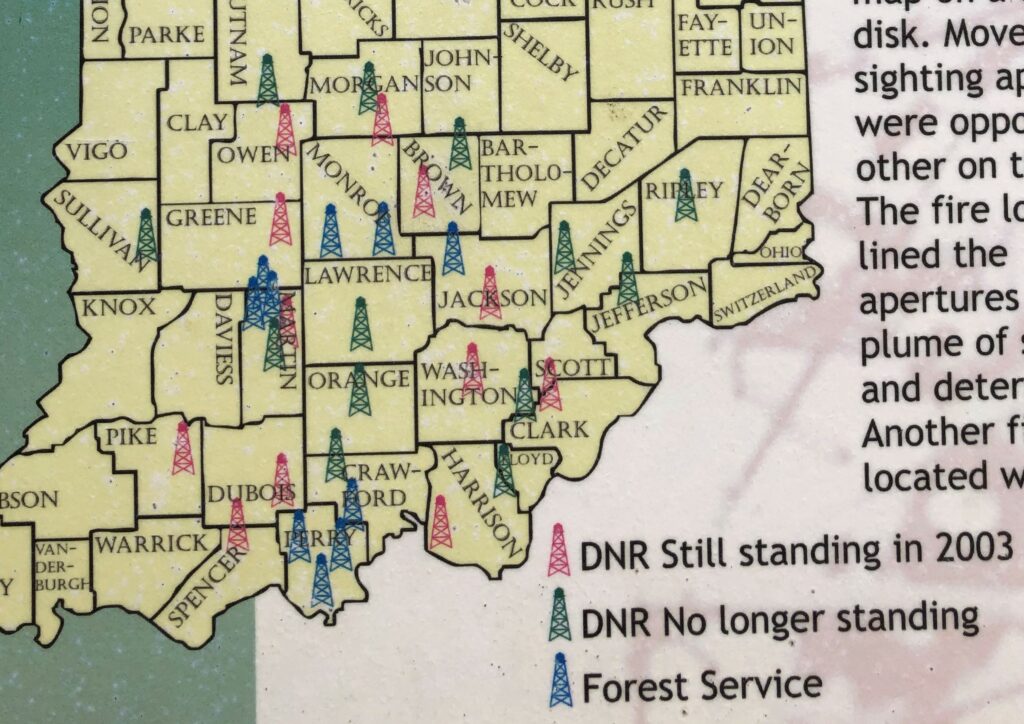
I typically look at the detail of the southern section, where most of the towers are. The three tower sites in the north are easy to track.
I think this sign is very reliable. There are a couple icons that appear on the line between two counties, so it’s not exactly clear which county they are indicating, if the designer was trying to indicate the correct county at all. Like, Hickman Hill is in Floyd County, but the icon is sort of on the edge of Floyd and Harrison.
I don’t know who made it; wish I did!
The towers on this sign
I count 38 towers on this sign. Here’s how I count the ones per color, but I’m not 100% certain about the blue vs green on some of them. (These signs live outside.)
Red DNR “still standing”: 14. Two in the north, twelve in the south:
South:
Cincinnati (Greene) – in 2024 this tower is standing but without a cab and not public
Ferdinand (Dubois)
Hartwell (Pike)
Henryville (Clark)
Lincoln (Spencer)
Mason Ridge (Monroe)
McCormick’s Creek (Owen)
Salem (Washington) – in 2024 this tower is standing but not public
Skyline (Jackson)
Weed Patch (Brown)
Willow Valley (Martin)
Wyandotte (Harrison)
Green “DNR No longer standing”: 14. One in the north, and thirteen in the south.
Blue “Forest Service”: 10. Some of these ten are standing and some are not. One in Jackson County; four in or near Perry; three in Martin; two in Monroe (Hickory Ridge, Dutch Ridge)