This page is about all the fire towers at Crane (unlike all my other pages which are about a single tower site.)
Information
Names: Indian Springs and Trinity Springs for one of the towers; no names for the other towers.
Location: Crane US Naval Ammunition Depot
County: Martin (aside from the Crane towers, Martin County also has Willow Valley and Shoals)
Topo quads: Indian Springs and Williams
Condition: There are two standing ‘normal’ fire towers; one partially deconstructed tower; and one tower that is now part of a water tank tower. (As of February 2025.) These are all on restricted federal Naval property, and there is no public access to these towers whatsoever. It is not possible to visit or climb these towers.
My notes about Crane towers
I was escorted through Crane in February 2025, along with Teena Ligman, to look at four tower sites. I need to update this page with new information.
There are three towers which appear on topo maps and which also appear standing on recent satellite imagery. These three towers clearly appear on Google Maps satellite view. Two of them appear complete, and the third appears to have at least part of the base still standing.
Three towers are seen on the topo maps from the year 1978, but don’t appear on most other editions like 1956. Two are on topo map Indian Springs and one is on topo map Williams. I have seen the names Indian Springs and Trinity Springs, but I don’t know with certainty which towers go with which names (if anyone does.) Are there names for these towers? None of the maps have names for these towers, unlike many of the other towers that are named on old topos. The main Forest Service web page with the big list doesn’t have names for these Crane towers either.
Tower names
The southern Crane tower is the only one that seems to have a name (or two.) Indian Springs and Trinity Springs are both town names near the southern tower. I think both of these names have been applied to this southern tower.
The National Geodetic Survey (NGS) has a mark named INDIAN SPRINGS LOOKOUT TOWER (JA1932) referring to the southern-most of the Crane towers. I think this is fairly solid evidence that the southern tower was named Indian Springs.
The name “Trinity Springs” is mentioned in the text on a USDA flyer about Hickory Ridge Lookout Tower: “The CCC camp, located in Kurtz, not only built the lookout tower at Hickory Ridge and Dutch Ridge, but also one at Trinity Springs.”
Four towers at Crane
The USFS Hoosier National Forest lookout towers page mentions 4 towers in Crane. Quote:
The U.S. Naval Ammunition Depot at Burns City in Martin County operated four towers during World War II.
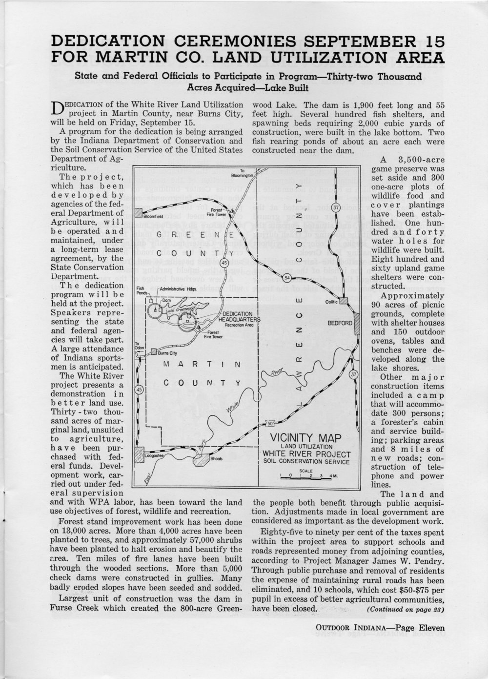
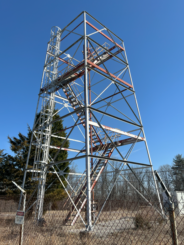
- Fire Tower One – near the Bedford Gate is still standing and was used until the mid 1970s. Crane Structure 1853
- Fire Tower Two – ? The base now supports a water tower
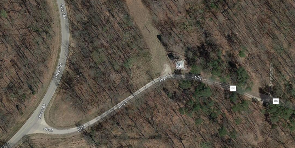
- Fire Tower Three – Located on JT21, now has a repeater antenna on it. Crane Structure 44
- Fire Tower Four – ? This tower was torn down in January 2009.
The FFLA site about Indiana towers claims that there were 4 Crane towers.
NGS notes about towers:
- The INDIAN JA1933 mark, which is not at any of the three known tower sites, has a 1946 station description that says it is “81.48 FEET EAST OF THE LOOKOUT TOWER”. Was there a lookout tower just west of this mark, or is it referring to the tall part of the building that is just to the west of this mark?
- The OSBORN RM 3 JA1940 mark, which is not at any of the three known tower sites, has a 1946 station description that says it is “ABOUT 1 MILE NORTHWEST OF A PROMINENT WATER TOWER THAT IS BUILT OVER AND AROUND AN OLD FOREST SERVICE LOOKOUT TOWER”. It’s easy to find Water Tank 4 (mark JA1930), and on the satellite map there is a water tower that is on a tower that could easily be an old lookout tower. Then again, on a satellite photo, an old water tank tower pretty much looks like an old fire tower. Tank 1 and Tank 3 towers look the same.
Maps related to Crane fire towers
General maps about Crane
Above: A random picture of Crane context from the internet
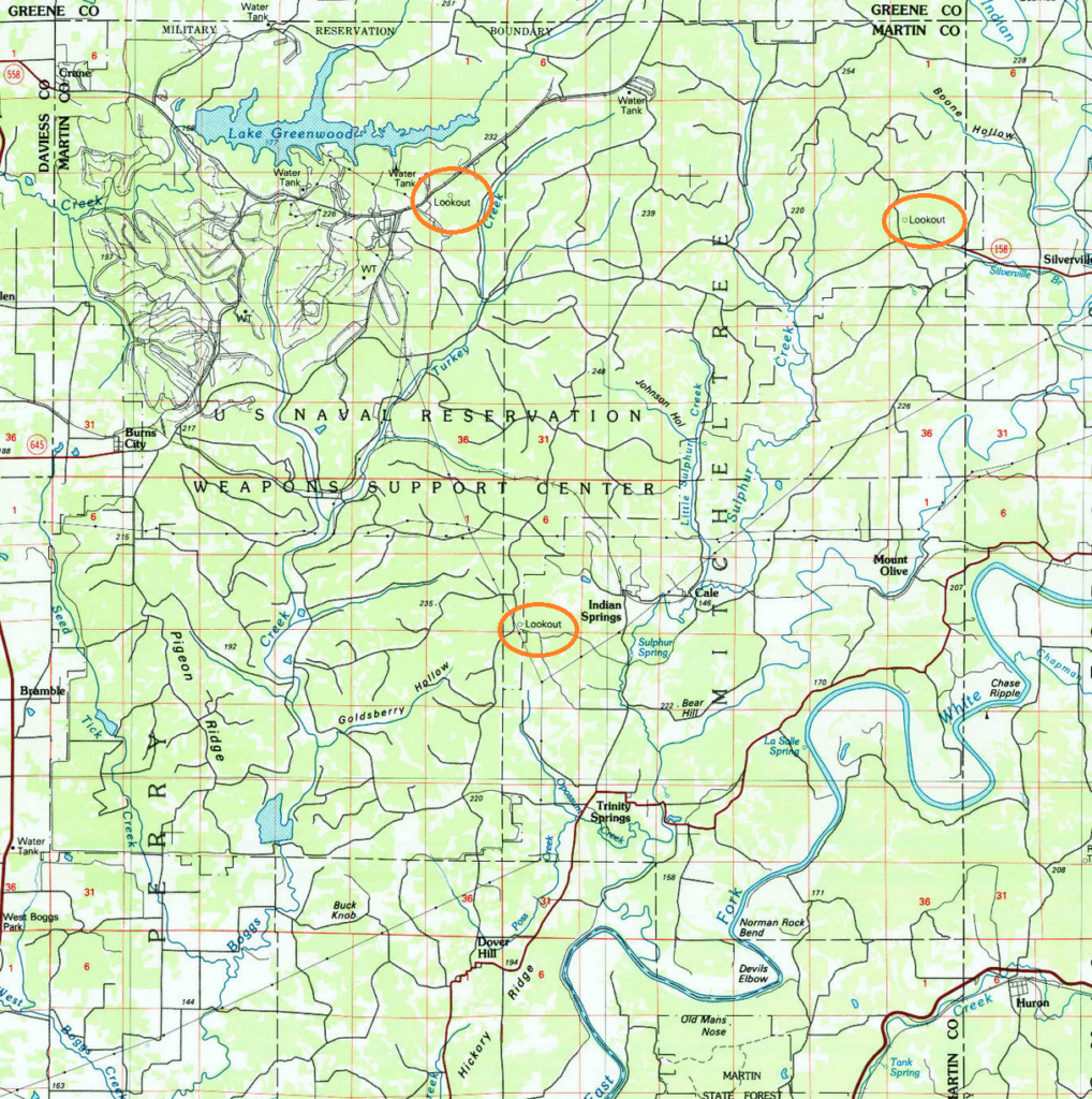
Above: Crane area in Bedford 100000 topo from 1986, showing three lookouts (the orange circles are mine)
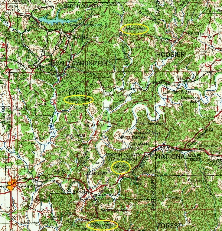
Above: Crane area in Vincennes 250000 topo from 1956, showing two lookouts in Crane and further south the Willow Valley and Shoals towers (yellow circles are mine)
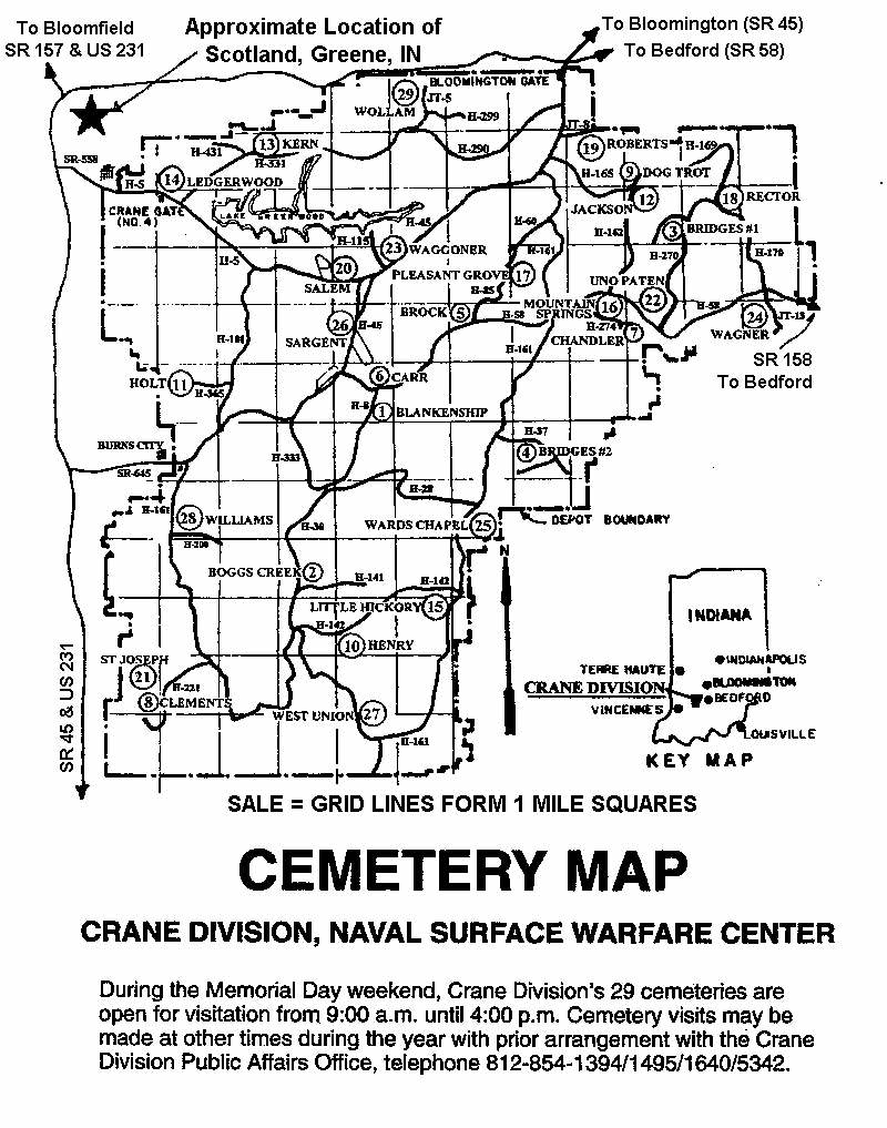
Above: A cemetery map of Crane area, interesting as a resource because some mentions of the tower sites historically mention which cemetery they’re near; one is near Waggoner Cemetery, and one is near Little Hickory Ridge Cemetery.
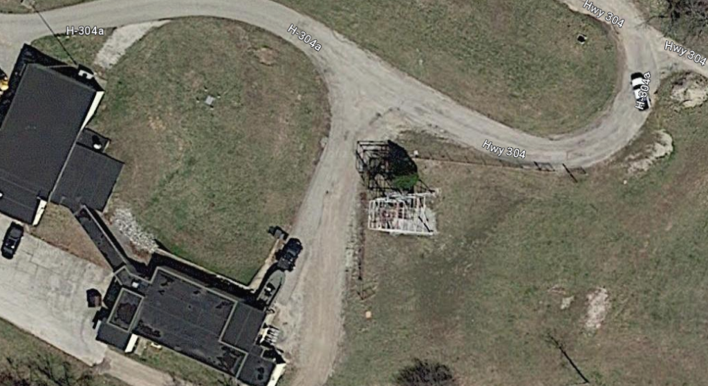
Maps of Crane tower “near the Bedford gate”
This is the northeastern tower in Crane. It’s north of Wagner Cemetery. It’s west of Silverville. This tower appears to be standing and complete on recent satellite photos.
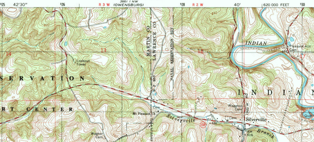
Above: Williams topo 1978 (I assume this is the tower described as being ‘near the Bedford gate’)
Above: Williams topo 1993; this is the only one of the towers that still appears in 1993
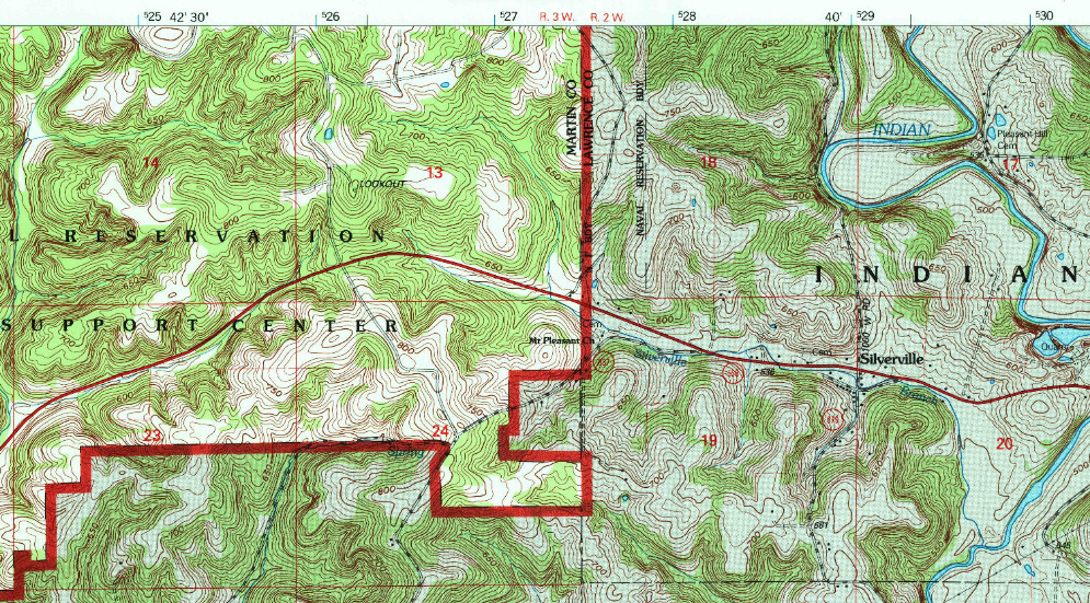
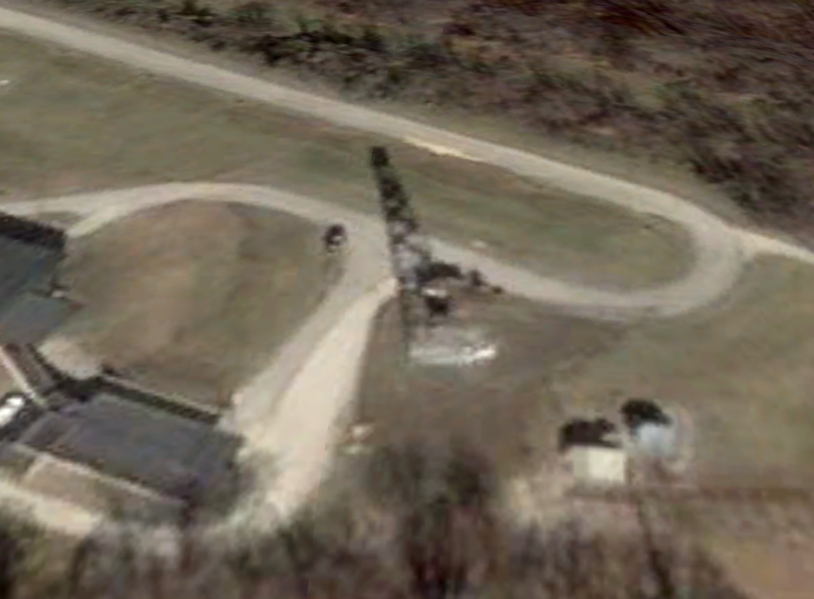
Maps of Crane tower near Waggoner Cemetery
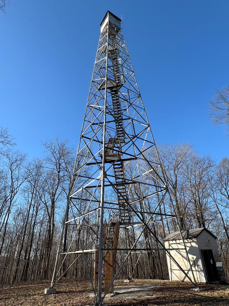
This is the northern tower in Crane, near the lake. It’s near Waggoner Cemetery. On satellite photos, this tower appears to be partially demolished.
Above: Indian Springs topo 1978; this tower is near Waggoner Cemetery, and the lake, and many other buildings.
There is an NGS mark near here named INDIAN JA1933, but that mark is on the north side of the road, and this tower is south of the road.
Maps of Indian Springs tower “located on JT21”
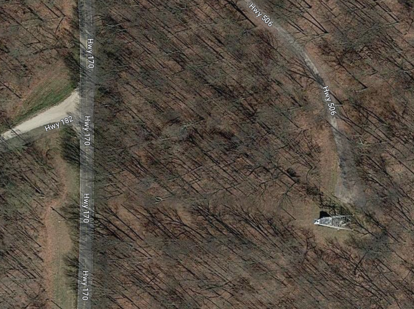
This is the southern tower in Crane.
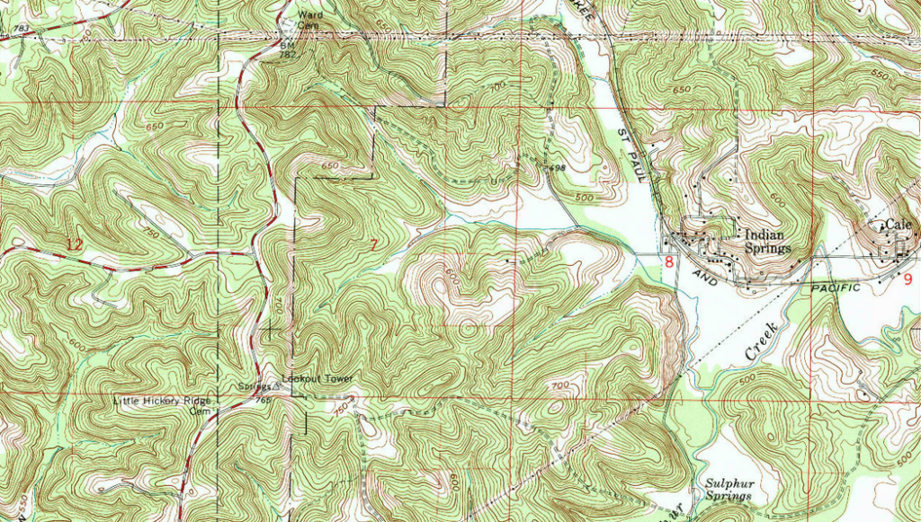
Above: Indian Springs topo 1978; this is near Little Hickory Ridge Cemetery. Note that this is near the NGS mark named “Springs” which can also be found on the NGS Map.
Satellite photos of Crane towers
Crane eastern tower “near the Bedford gate”
Above: Recent satellite photo of the northeastern tower site in the northeast
Crane northern tower (near Waggoner cemetery)
Recent satellite photo of the tower site near Lake Greenwood and Waggoner Cemetery. In the upper photo, it looks like the cab is missing. But in the lower satellite photo from 2004, it looks like the whole tower is still there.
Indian Springs, southern tower “located on JT21”
Above: Recent satellite photo of the tower site near Indian Springs, the southern-most of the three. This is off ‘highway 161’.
Links and Sources for Crane towers
One interesting source is the book “The World War II History of NAD Crane” (https://www.blurb.com/books/6856367-the-world-war-ii-history-of-nad-crane) which has one picture (page 68) that includes a lookout tower, and other aerial photos that one could imagine were taken from towers on site.
NGS datasheet for mark INDIAN (JA1933) said to be about 81 feet away from a tower near Lake Greenwood.
NGS datasheet for mark INDIAN SPRINGS LOOKOUT TOWER (JA1932) and the datasheet for the nearby SPRINGS (JA1937)
History of Crane
In the 1800s, the mineral springs in Martin County led to settlement and eventually tourism. An October 1976 Outdoor Indiana article about the area discusses the numerous hotels around Trinity Springs and Indian Springs in the late 1800s and early 1900s. A February 1986 OI article mentions that a resort at Trinity Springs was opened in 1840; and a resort near Indian Springs was there in 1814; Indian Springs ceased to exist as a health spa after 1900.
History of Crane before WW2
In the 1930s, this area in Martin County was being called the White River Land Utilization Project as a project between the USDA Soil Conversation Service and the Indiana Department of Conservation.
There are references online that some of this land in Martin County was being planned for a state park, before World War II started.
Above: This pre-Crane map above shows two towers. This implies that these two towers existed in September 1939. The one in Greene County would be Cincinnati. The tower near Greenwood Lake is therefore one of the Crane-area towers. The name for this area at the time was “White River Land Utilization Project.”
Another story in the November 1939 issue of OI says that Greenwood Lake is 800 acres and the largest artificial lake in Indiana.
On the map on the back of the OI magazine in May and July 1941 issues, this area is being referred to as the Martin County Land Use Forest.
I have a number of pre-WW2 maps that show the towers of Indiana on my Black and White Maps page. The 1935 map has no towers in the Crane area; only the Martin County State Forest tower. The 1939 map has three towers in Martin County, implying that at least one of the Crane towers is standing.
A personal resource says that the Structure 1853 tower was built in 1938.
Crane after WW2 begins
A personal resource says that the Structure 44 tower was built in 1942.
This area in Martin County becomes a naval ammunition facility as WW2 begins.
This federal facility has different names over time:
- Recent name seems to be “Naval Surface Warfare Center, Crane Division (NSWC Crane)”.
- Google Maps calls this Naval Support Activity Crane.
- I’ve seen “NAD Crane” and “NSA Crane”
- USFS page calls this “U.S. Naval Ammunition Depot”.
- Old topos say “US Naval Reservation Crane Ammunition Depot” or “US Naval Reservation Weapons Support Center”.
In the March 1942 issue of Outdoor Indiana, this area around Greenwood Lake is being referred to as the Naval Ammunition Depot.
The Indian Springs (southern) tower is mentioned as existing in 1946 according to the JA1932 and JA1937 marks’ descriptions.
One of the latest black and white maps, maybe from 1952, shows five towers in Martin County with three of them noted as being in Crane.
Coordinates of Crane towers
Crane eastern tower “near the Bedford gate”
| Coordinates | Latitude | Longitude |
| My coordinates from maps (unofficial) | 38.866729 | -86.697959 |
| Coordinates taken onsite | 38.866728 | -86.697976 |
Crane northern tower
| Coordinates | Latitude | Longitude |
| My coordinates from maps (unofficial) | 38.871783 | -86.808266 |
| NGS datasheet coordinates for INDIAN (JA1933) (somewhat nearby) | 38 52 27.53636(N) | 086 48 46.58235(W) |
| Coordinates taken onsite | 38.871832 | -86.808350 |
Indian Springs – Crane southern tower
| Coordinates | Latitude | Longitude |
| My coordinates from maps (unofficial) | 38.788962 | -86.791180 |
| NGS datasheet for INDIAN SPRINGS LOOKOUT TOWER (JA1932) (map) | 38 47 20.30846(N) | 086 47 28.23440(W) |
| NGS datasheet for SPRINGS (JA1937) (map) | 38 47 19.79737(N) | 086 47 28.69987(W) |
| Coordinates taken onsite | 38.788948 | -86.791256 |
Fourth tower site – water tank tower
| Coordinates | Latitude | Longitude |
| Coordinates taken onsite | 38.849305 | -86.857685 |
Personal pictures and notes for Crane towers
In February 2025, Teena Ligman and I were escorted through the Crane property to look at four tower sites. We visited the eastern lookout tower, the southern lookout tower known as Indian Springs, the half-deconstructed tower in the north, and an old tower site that is currently part of a water tank tower.
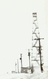
Above photo: eastern fire tower in Crane
Above: Indian Springs tower, also known as Structure 44.
Above: remnants of a Crane tower
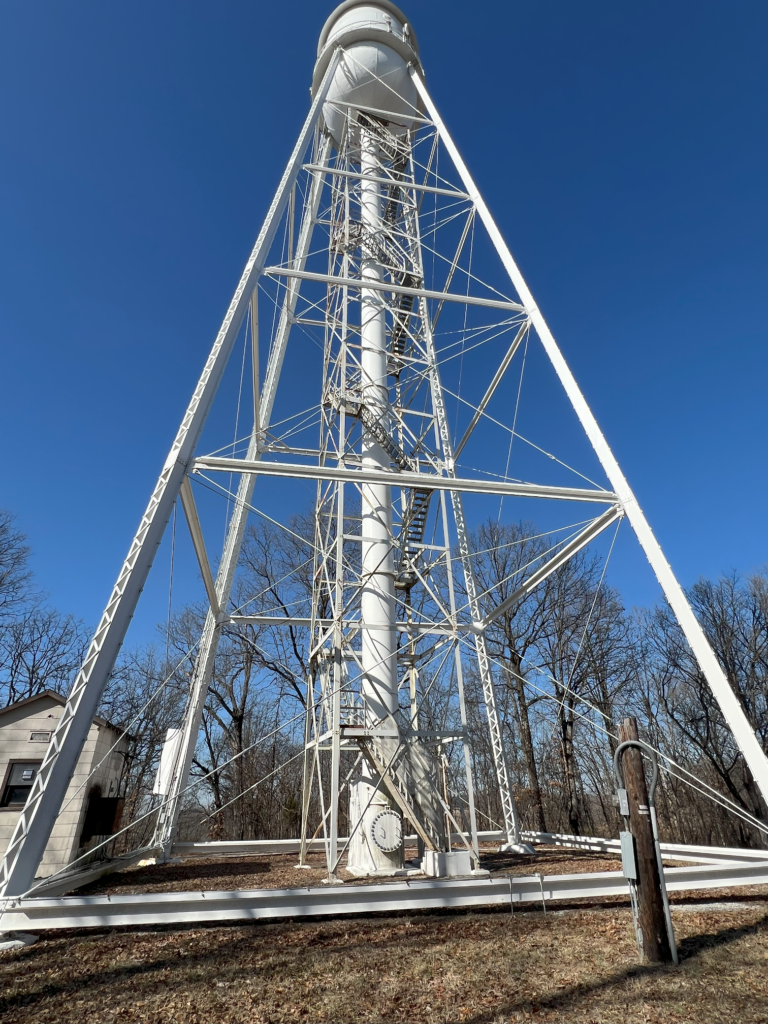
Above: old fire tower now with a water tank tower at the site