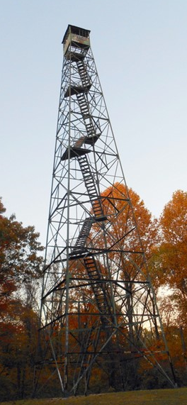
Information
Names: Hartwell
Location: Pike State Forest (previously named Pike County State Forest)
County: Pike
Topo quad: Augusta
Condition: Standing; it was in bad repair and not climbable when we visited it
Maps
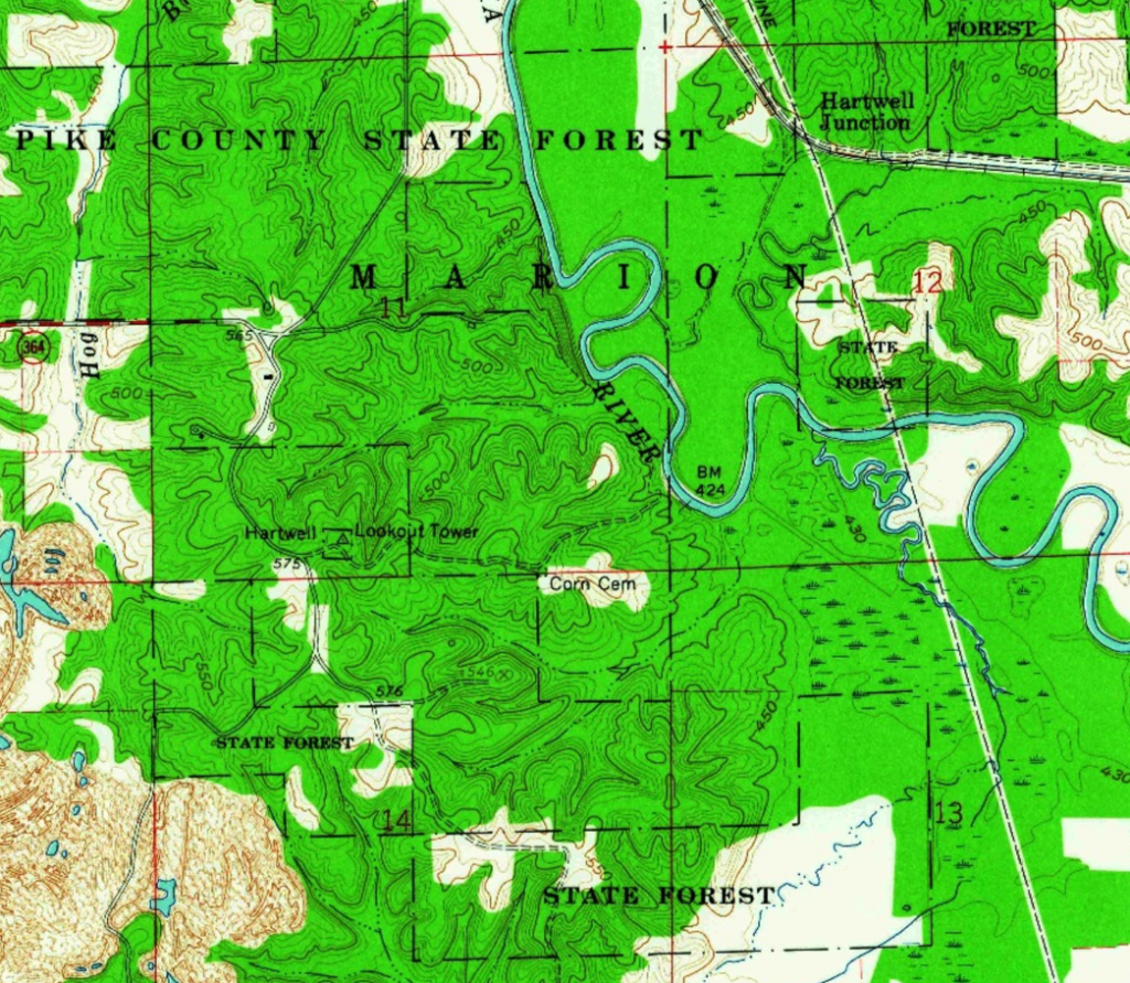
Above: Augusta topo from 1961
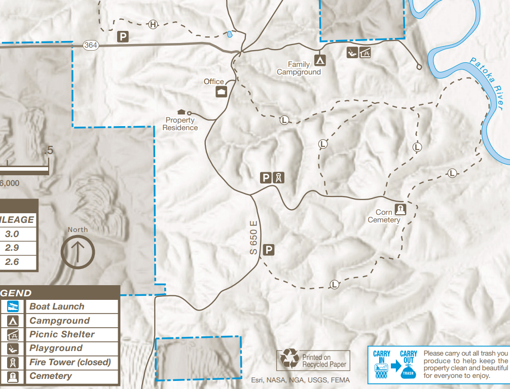
Above: Pike State Forest map detail with tower in the middle
Links about Hartwell tower
National Historic Lookout Register page for Hartwell
Pike State Forest trail map PDF
NGS datasheet for HARTWELL LOOKOUT TOWER (JA1972)
Structural Survey number 125-028-30022
Data
| Coordinates for current site: | Latitude | Longitude |
| My coordinates (unofficial) | 38.349728 | -87.157521 |
| NHLR coordinates | N 38° 20.984′ | W 087° 09.451′ |
| NGS datasheet for current location (map) | 38 20 59.23108(N) | 087 09 26.54005(W) |
History and previous tower site
It seems clear to me that there was an early different site for the Pike State Forest tower. There is an NGS mark named FIRE TOWER NEAR FRITZ CORNER JA1971 (datasheet) nearby that looks to also have been in Pike County State Forest. The 1936 Pike County cultural map shows a Fire Tower off of old I-64 southwest of Augusta, which is where this JA1791 mark is.
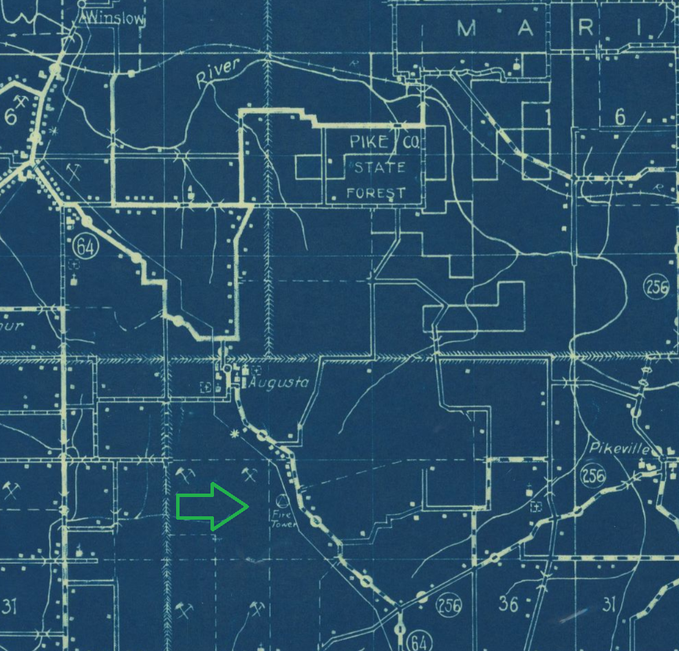
Above map has my green arrow showing where the previous tower site was around 1936.
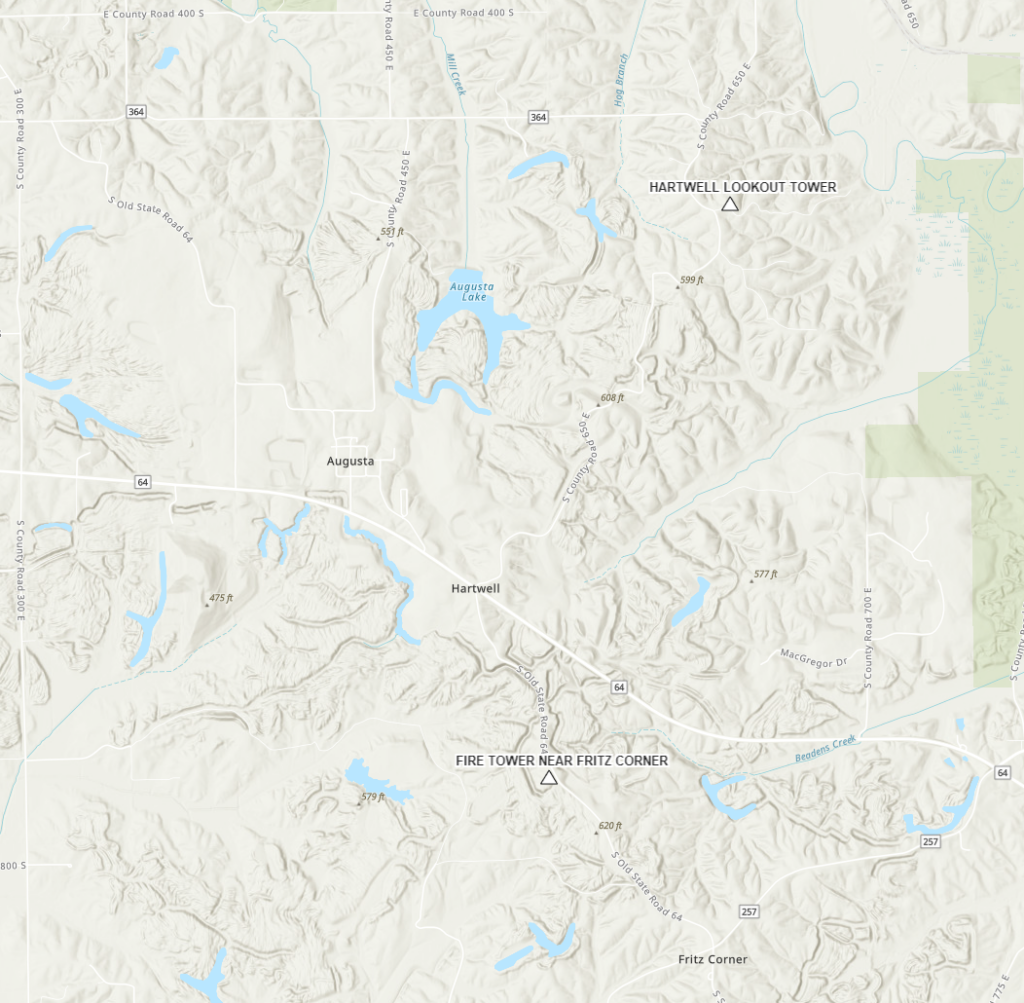
Above map shows two NGS marks for Pike County State Forest tower sites, the current site to the north and the older site to the south.
Tower existed in 1946 at the current site according to the NGS datasheet for JA1972.
Structural Survey page just says: “Constructed prior to 1952 to serve as a lookout for forest fires”. A document on that site says: “This tower was
built between 1935 and 1952 and replaced a previous tower which was located south of Highway 64.”
Outdoor Indiana has an article about Pike State Forest in the November 1975 issue (link to IU Digital Library page)