Information
Names: Henryville, (also possibly Grandview Tower for the early site)
Location: Clark State Forest (once known as Clark County State Forest)
County: Clark
Topo quad: Henryville
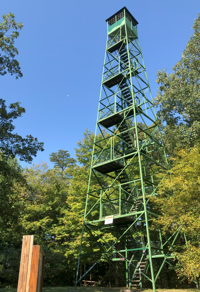
Condition: Standing; climbable generally but not currently. It has been under repair and closed to climbing in 2023 and 2024. Updates can be found on the forest webpage.
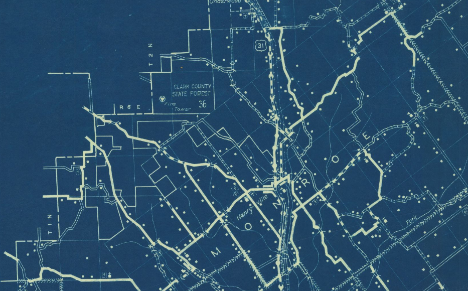
Maps of Henryville tower
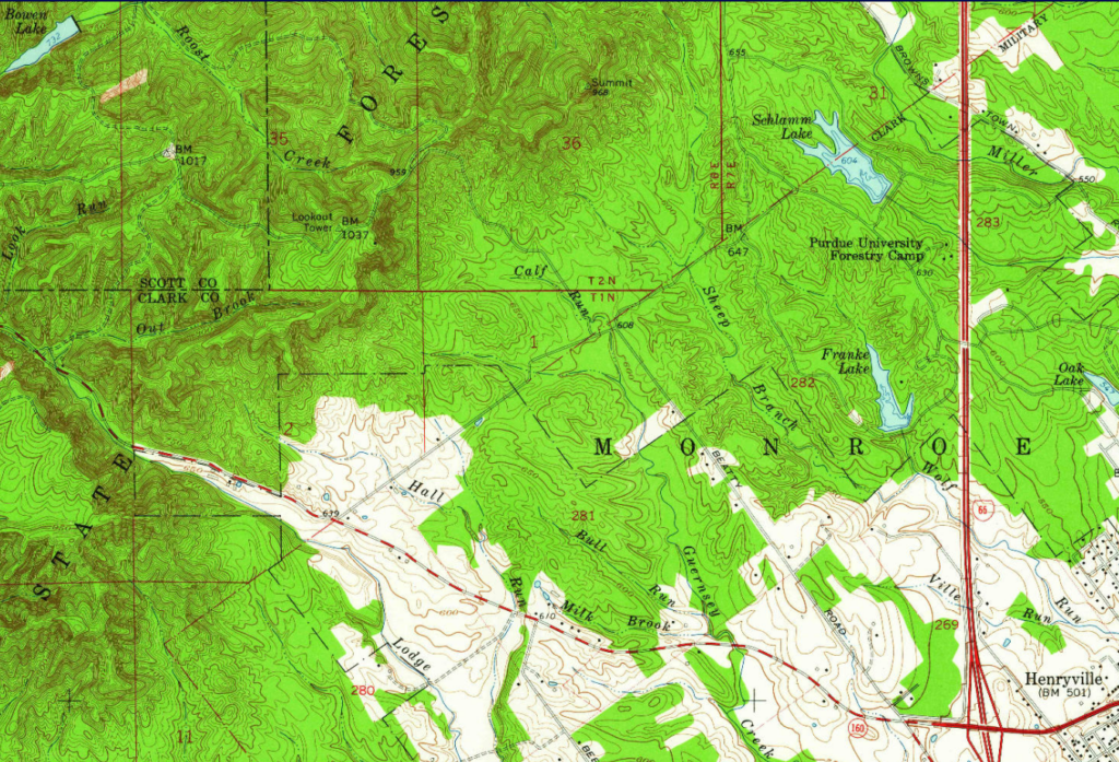
Above: Henryville topo, 1960, excerpt with tower in upper-left
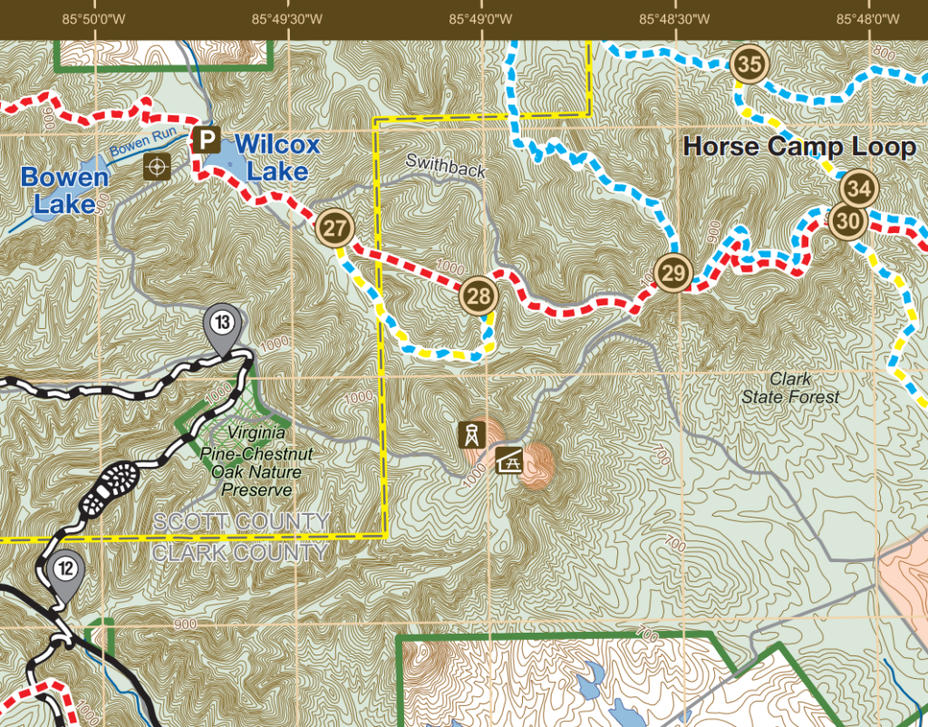
Above: Clark State Forest map excerpt with tower icon
Links
National Historic Lookout Register page for Henryville
Clark State Forest south map PDF
Indiana Structural Survey number: 004-273-01009
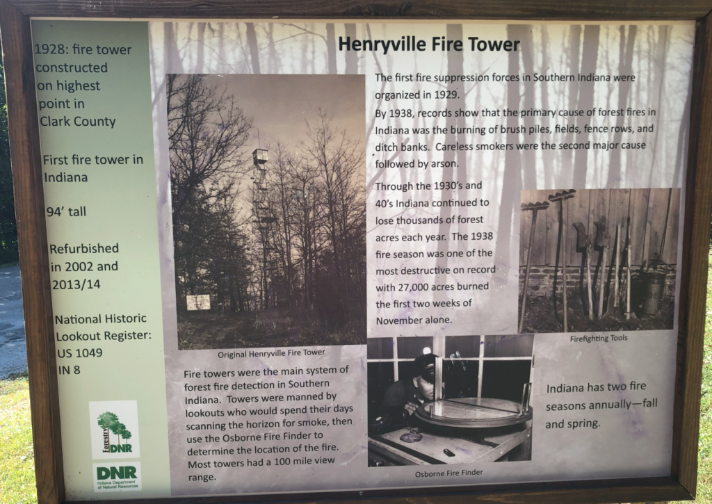
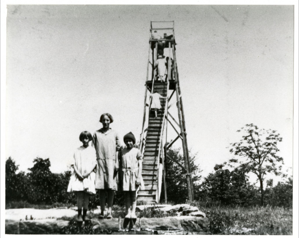
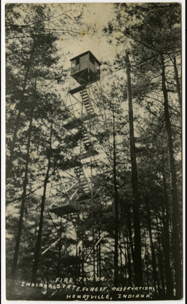
Picture of the original wooden tower; post card of steel tower
Data
| Coordinates for the current tower | Latitude | Longitude |
| My coordinates (unofficial) | 38.56438 | -85.81686 |
| NHLR coordinates | N 38° 33.863′ | W 085° 49.012′ |
History of Henryville tower(s)
This tower site is generally considered the oldest fire tower in Indiana.
Clark State Forest was the first Indiana state forest, established in 1903, originally known as Clark County State Forest. The state’s first forest nursery was there.
There have been two tower sites in Clark State Forest, about one mile apart. The original site in the late 1920s had a wooden tower, and was about one mile northeast of the current site.
The 1926 Department of Conservation annual report mentions the original tower: “A telephone line is now being constructed to Grandview Tower, which will be used as a fire tower until a steel one can be erected.” I’m guessing that this was a name for the original wood tower, although I’ve never seen that name on any maps.
The 1927 annual report says: “There are two fire towers on the state forest. One is at the top of the ‘hill road’ and is accessible by automobile. The other tower was erected by the United States Government for geodetic survey work.
The Indiana structural survey 004-273-01009 has this note: “1928 Annual Report notes construction of ‘new steel fire tower’. No evidence that the Civilian Conservation Corps (CCC) replaced it.”
A list of towers in the Indiana Department of Conservation’s 1932 annual report says this tower was erected in 1927. The sign on site says it was constructed in 1928.
Part of the forest is on land that was part of Clark’s Grant from 1781, which is I think the oldest part of what would become Indiana, which may explain why the first state forest is here.
Notes about Henryville tower
This tower was closed for repairs in 2023 and 2024, and as of January 2025 I’m not sure if it’s open. It is expected to re-open at some point.
My brother and climbed the tower up and into the cab in 2021. It’s right off a road and easy to find, but you should pay attention to whether roads are gated in certain seasons. We walked to the Henryville tower as a moderately short diversion from the Knobstone Trail. Very nice.
There is no NGS mark at the current tower’s site. There is a mark just to the northeast: SUMMIT 1886 (HZ2346) which is an old one starting in 1914 or earlier. The 1931 update on its datasheet provides tower information: 1) There was “an old lookout tower of hard wood” at this site; 2) the modern tower existed in 1931.
Previous site name: “Government”
In addition to the current Henryville tower, there is evidence for a previous older tower site, just under one mile to the northeast. The Forest Fire Lookout Association’s page about Indiana towers lists this as a separate site named “Government”. The evidence I’m aware of for this is in the NGS bench mark notes for SUMMIT 1886 (HZ2346). The notes describe an old wood tower on what was once called “SALAAM KNOB” and then later called “GOVERNMENT LOOKOUT KNOB”. I assume that the site name “Government” comes from this name of the hill. (Personally I would just consider these both part of the same overall site, not two sites, but it’s a subjective choice.)
Personal photos