Information
Names: Hickman Hill, Floyd County Lookout Tower, Floyd Lookout Tower
Location: southwest of New Albany
County: Floyd (the only tower in this county)
Topo quad: Lanesville
Condition: Not standing
Maps of Hickman Hill tower
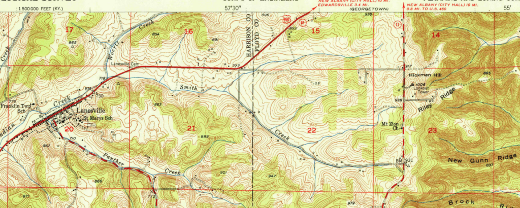
Above: Hickman Hill lookout tower in Lanesville quad topo from 1951
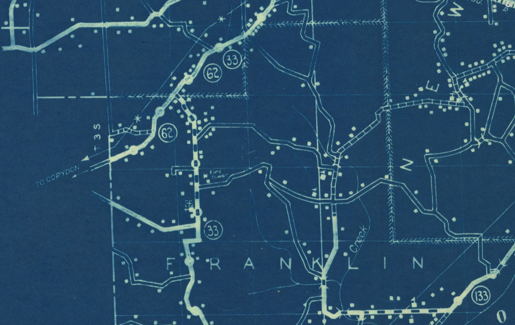
Above: This county cultural map indicates that the tower existed in 1936, the date of this map. (Map description: ‘Map resulting from a 1936 survey of roads in the county showing information about the built landscape, including, but not limited to, dwellings, churches, schools, factories, and cemeteries.’)
Links
NGS datasheet for mark FLOYD HZ2261 which is described as ten meters from the tower site, and HZ2263 which was beneath the tower. The tower is described in the original 1947 description of both marks’ datasheets.
Data
| Coordinates | Latitude | Longitude |
| My coordinates (unofficial) | 38.241585 | -85.931096 |
| NGS datasheet for HZ2263 | 38 14 28.98219(N) | 085 55 51.39008(W) |
History of Hickman Hill tower
This tower was constructed by 1935.
This tower was not on a major state park or state forest property. It’s shown on a 1935 map, but not discussed much in the DoC annual reports. I would speculate that this might have been a private tower.
This tower was probably standing in 1947 and 1951.