Information
Names: Indiana Dunes
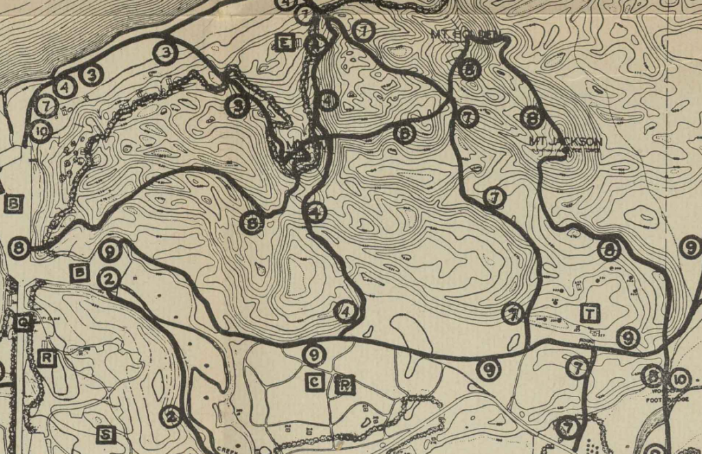
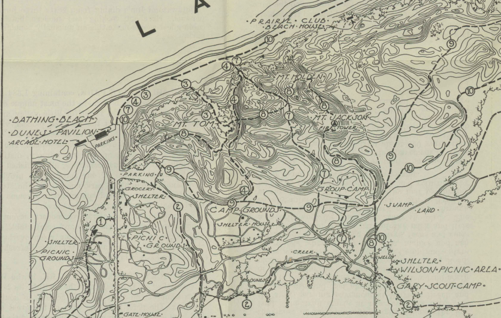
Location: Indiana Dunes State Park, Mt. Jackson specifically
County: Porter
Topo quad: Chicago 1:250,000; Porter 1:62,500; Dune Acres 1:24000
Condition: Not standing; long gone
Maps
Very old Indiana Dunes State Park maps show the tower on the state park maps
The Chicago 1:250,000 map from 1953 has a “Tower” in the state park vicinity, but it’s impossible to tell exactly what it’s referring to.
Links
Frank Hohenberger photo of a shadow of himself sitting on the tower (the page mentions Mt Tom instead of Mt Jackson)
State Park map from 1938 at Indiana State Library Digital Collections, and one from 1941
Data
Latitude:
Longitude:
History of Indiana Dunes tower
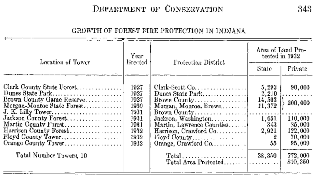
This tower was constructed in 1927 according to the Department of Conservation annual report of 1932.
A park map from 1932 mentions “Mt. Jackson (Fire tower for use of employees only)”
A history of the park mentions “a fire tower was placed on the summit of Mt. Jackson”.
A 1938 state park trails guide describes Trail No 8: “The trail then leads to the southeast and to Mt. Jackson where the park tower is located.”