Information
Names: Jasper-Pulaski
Location: Jasper-Pulaski State Game Preserve aka Jasper-Pulaski Game Preserve
County: Pulaski (the only tower in this county)
Topo quad: San Pierre
Condition: Not standing; no evidence remains
Maps

San Pierre topo 1959; tower just southwest of circular pond
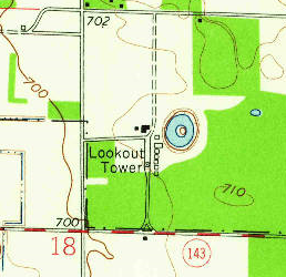
San Pierre topo 1959 closeup; tower is southwest of circular duck pond
Data
Latitude: 41.138446
Longitude: -86.918308
History
Land started to be acquired in 1929.

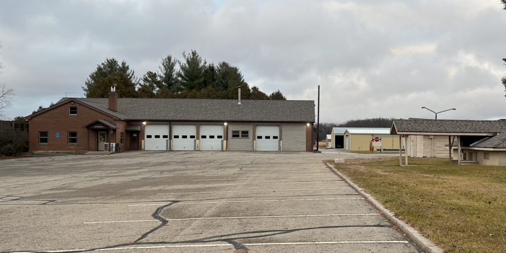
For reference, here’s a personal picture of this area from 2023. This photo is facing north; the round pond is off to the right of the photo.
Personal notes
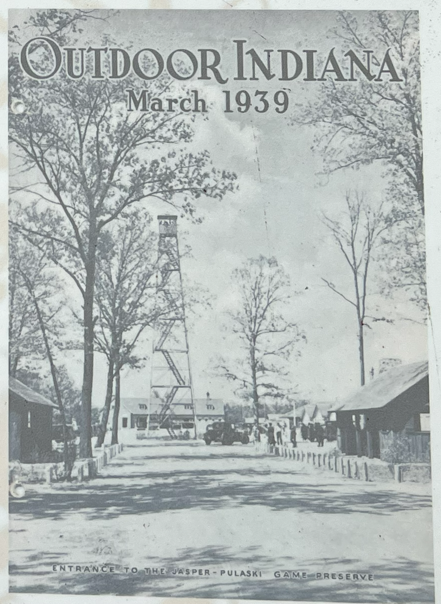
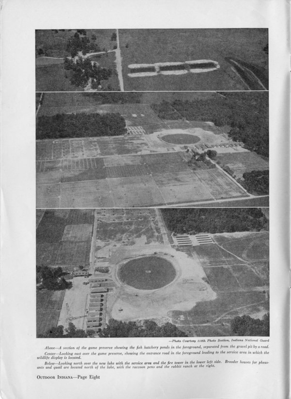
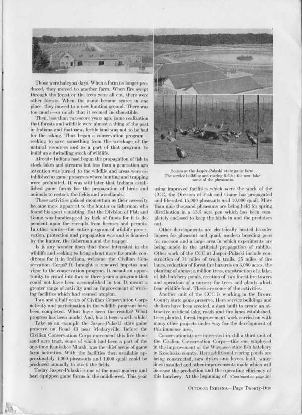
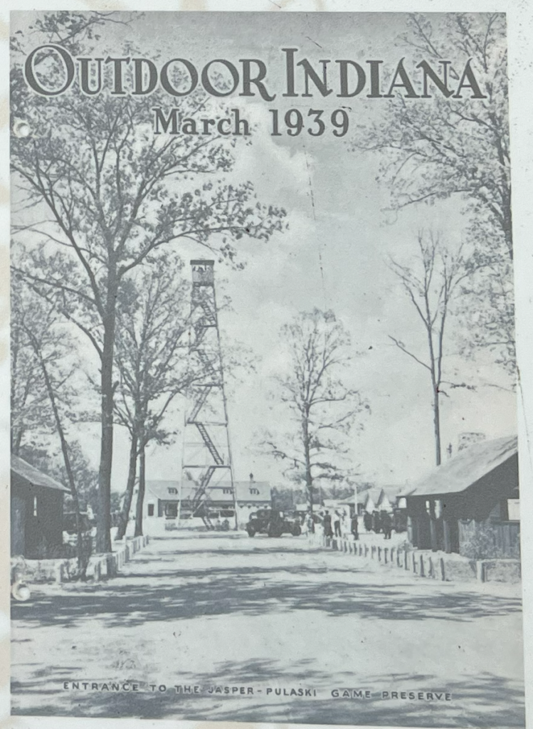
There is a picture of the tower on the cover of the March 1939 Outdoor Indiana magazine. This picture is used on the primary outdoor signs that one sees near existing towers today. This shows the tower in a clear area in front of a building. This suggests the tower was in the parking lot or driveway south of the building which is west of the circular pond. The building and pond exist in 2023.
I visited this location in December 2023. The location of the tower is where there is currently a parking lot. The old topo shows the tower at this location in a parking or paved road area.
In 2022 I was at nearby Tippecanoe River State Park, and I asked an IDNR employee at the park office about this missing tower. This person confirmed this location, and that they remembered there being a tower there when they were young. They told me there is no remnant of the tower now.