Information
Names: Shoals, maybe also Lacy
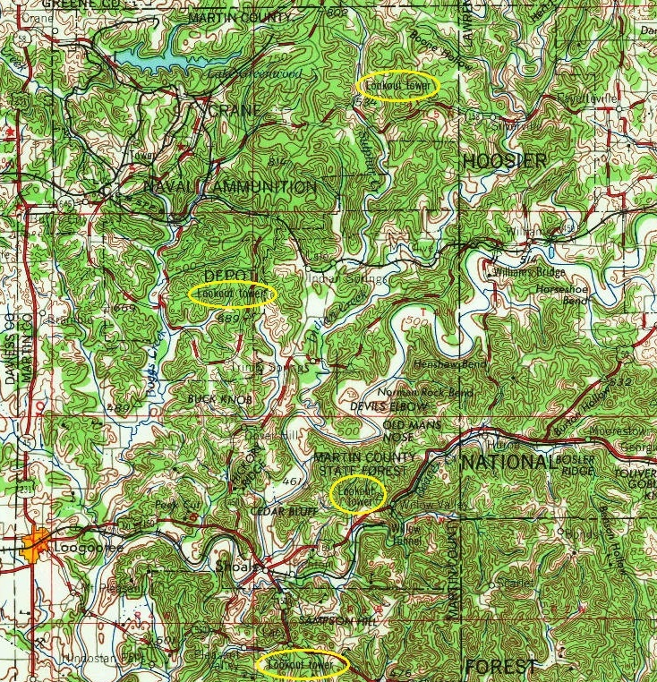
Location: South of Lacy. Possibly at one point in Martin County State Forest, and also in Hoosier National Forest property, Lost River Purchase Unit
County: Martin (along with Willow Valley and the Crane towers)
Topo quad: Shoals
Condition: Not standing (drove close to it but did not look for tower bases, so don’t know if they exist)
Maps
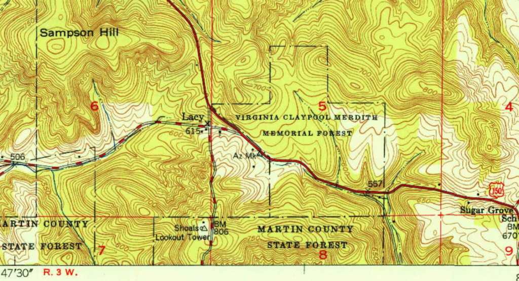
Above: Shoals topo quad, 1950; personally it looks like it was in a section of Martin County State Forest (what is now Martin State Forest)
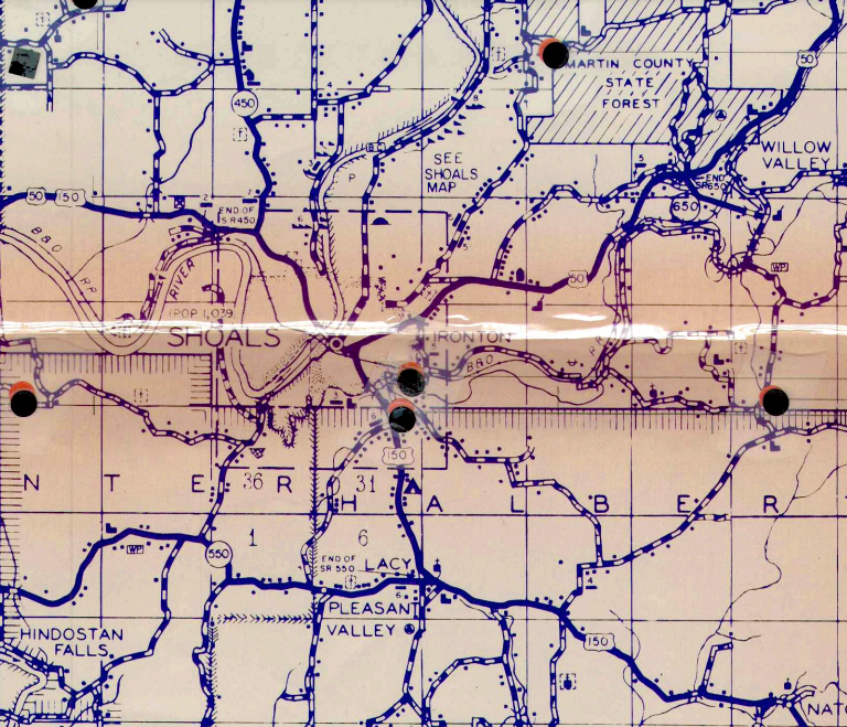
This is an image of an old Martin County transportation map I found on the internet. See the triangle-in-a-circle icons for the tower site south of Lacy. This might be from 1978. This and other maps suggest that the Shoals tower was in Hoosier National Forest.
Links
NGS datasheet for mark SHOALS LOOKOUT TOWER (JA1917). The 1946 description says is was “ON PROPERTY OWNED BY THE FOREST SERVICE”.
Data
| Coordinates | Latitude | Longitude |
| My coordinates (unofficial) | 38.626611 | -86.726546 |
| My coordinates (from our drive close to the site) | 38.62760 | -86.77671 |
| NGS mark coordinates | 38 37 38.67019(N) | 086 46 35.24779(W) |
Personal notes
Shoals seems like the right name, because it appears as Shoals on an old topo and in the NGS records. But the town it is nearest to is Lacy, and one might see how the name ‘Shoals’ could be confused for Willow Valley in Martin State Forest, because that’s a well-known tower and it is close to the town of Shoals; and therefore why someone might call this one ‘Lacy’.
We visited this location by car in 2023. We drove south from Lacy on Windom Road, and turned west onto a gravel road that felt like a forest road and also a private driveway; it was unclear just how private this was. This gravel road ended in a loop, which is a common sign of old tower sites, and what was probably a house, at which point we turned around. Precise tower location was indeterminate, but it seemed like we were within 100 feet of it.
The datasheet for JA1918 has a 1967 update that says “THE RANGER HOUSE HAS BEEN REMOVED AND THE LOOKOUT TOWER IS NO LONGER IN USE”.