Information
Names: Skyline
Location: Jackson-Washington State Forest, originally Jackson County State Forest or Jackson State Forest
County: Jackson
Topo quad: Vallonia
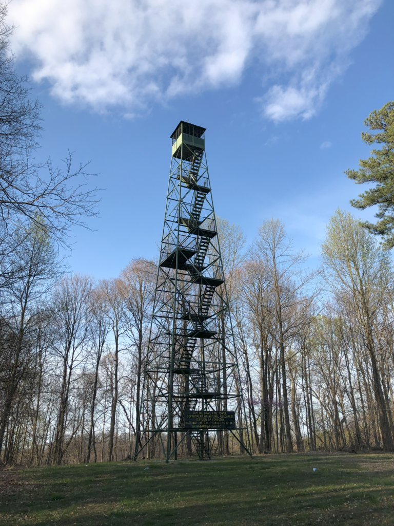
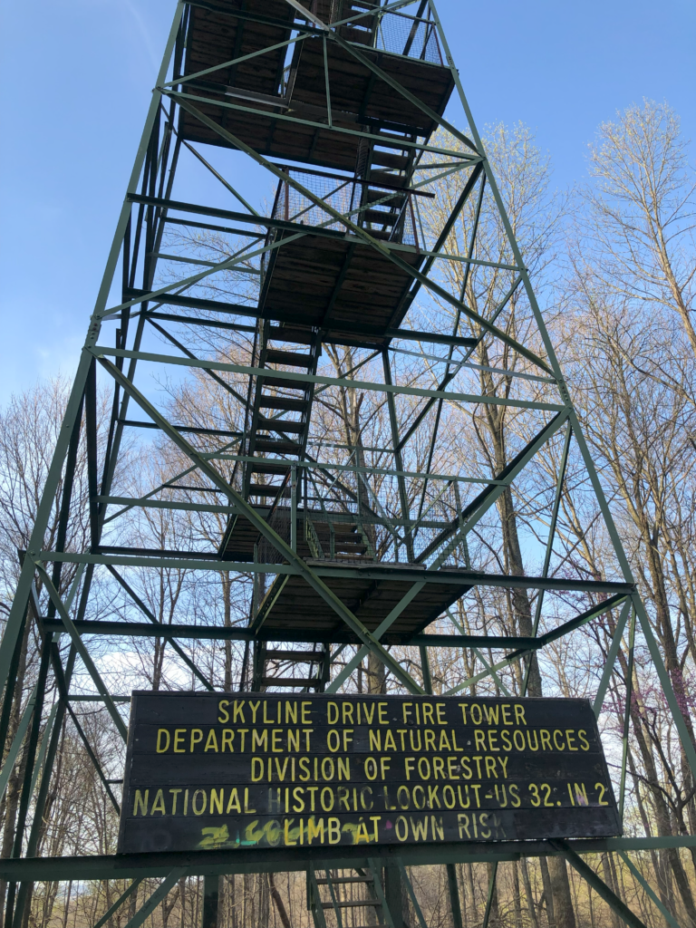
Condition: Standing, climbable up into cab
Subjective: Great tower
Maps of Skyline tower
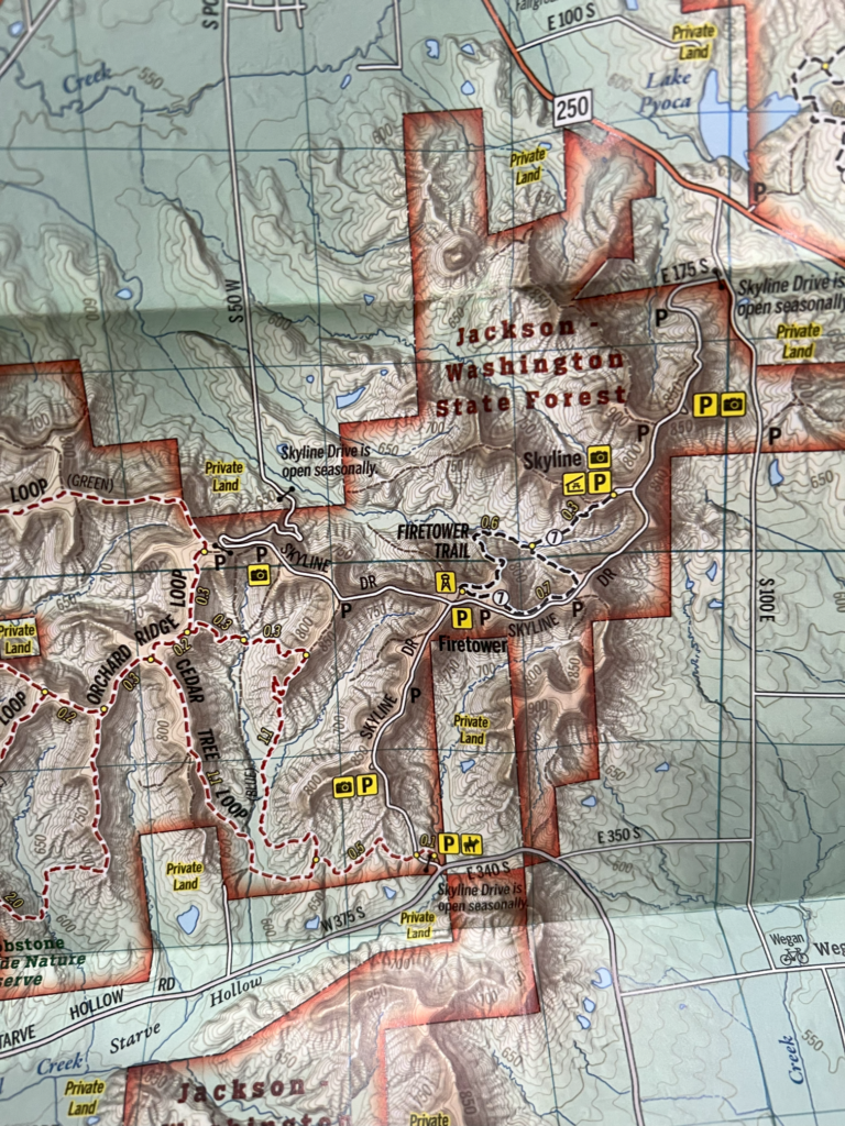
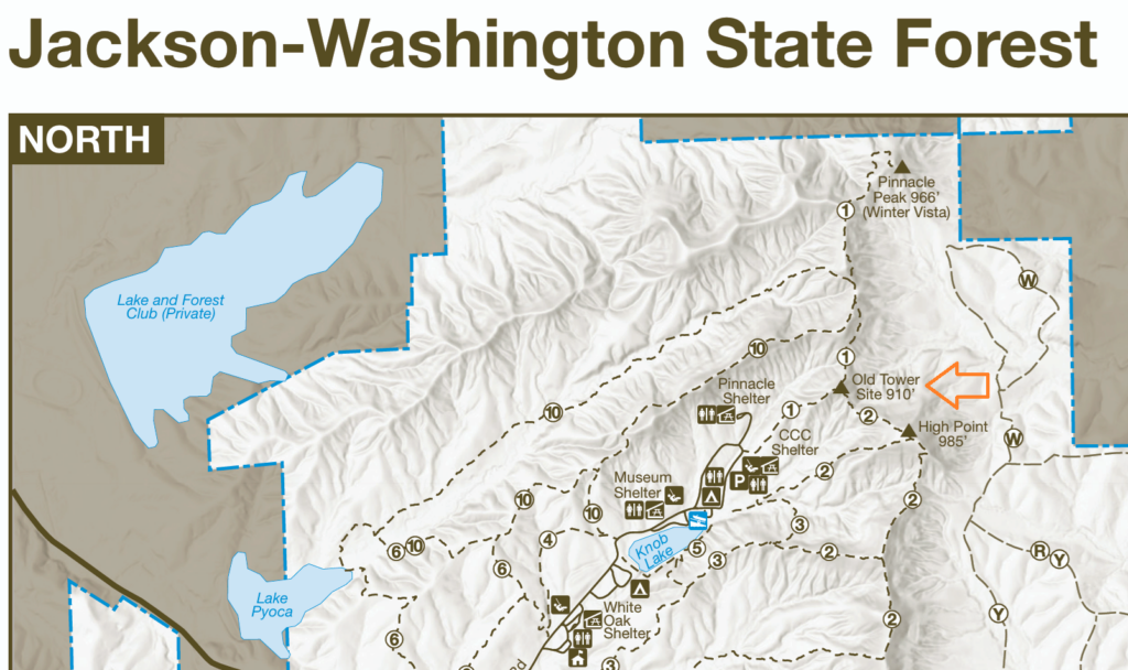
Maps of the current tower site
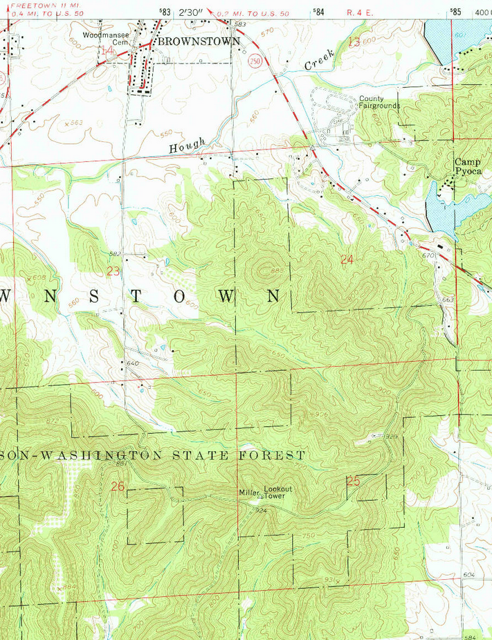
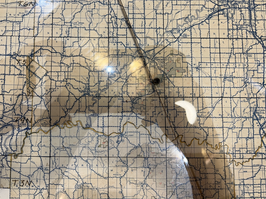
Above: Vallonia topo quad, 1959. (I think the word Miller on this topo is just the name of a nearby mark named after an orchard owned by a Miller, and has little to do with the tower.)
Above: detail of the Indiana Geological & Water Survey TM03 map
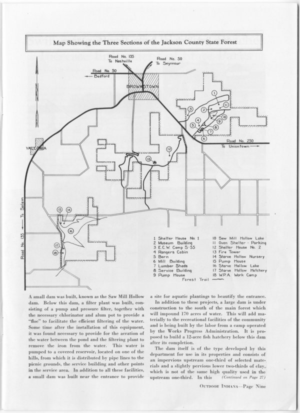
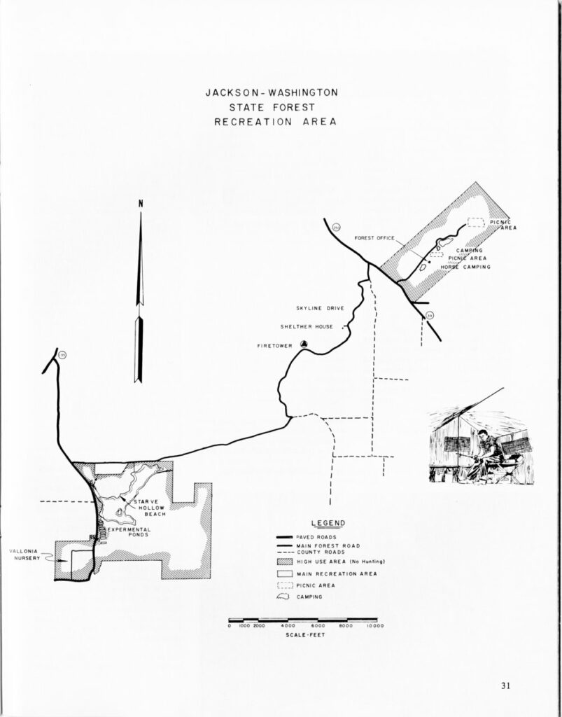
Map of first tower site at Jackson State Forest
This current map below, and some historical references, indicate that there was an original tower site — probably just an old wooden tower — at a location in the northeast part of what was then Jackson County State Forest.
Links about Skyline tower
NGS datasheet for mark SKYLINE LOOKOUT TOWER (JA1670) and nearby MILLER (JA1669)
Structural survey numbers 004-075-04011, 004-623-04009, 004-641-23009
Some gorgeous photos of Skyline tower at abandonedonline.net
Data
| Coordinates | Map | Latitude | Longitude |
| Mine (unofficial) | 38.84325 | -86.035576 | |
| NHLR | Google map | N 38° 50.595′ | W 086° 02.135′ |
| NGS JA1670 data sheet | Google map | 38 50 36.52023(N) | 086 02 08.29358(W) |
The alidade from Skyline
The alidade (fire finder) from Skyline is on display at the Morgan-Monroe State Forest nature center.
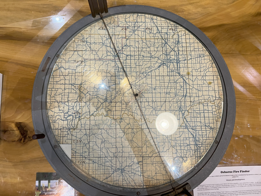
The Houston tower site is the only other tower I could see on this alidade’s map, to the northwest of Skyline which is at the center. Not visible in these photos. (I have more photos, just haven’t uploaded them here.)
History of Skyline tower
Land for the Jackson County state forest was purchased beginning in the 1930s.
There is evidence that there was a previous tower site at the Jackson County state forest, northeast of the current Skyline tower site. My sense is that it’s likely an old wooden tower was built at the northeastern site, and then the current steel tower was built later at the southwestern site.
The JA1669 nearby MILLER mark datasheet starts surprisingly early, in 1914. Its updates in 1914 and 1931 do not mention a tower. Its 1935 update does mention a “FOREST RESERVE OBSERVATION TOWER”.
The 1946 description from the NGS datasheet for JA1670 mentions the tower.
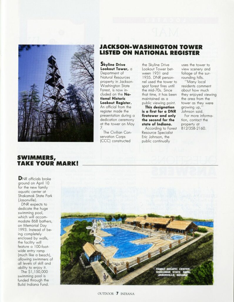
One of the survey pages says: “Although virtually identical to fire towers built by the Civilian Conservation Corps (CCC), this one was constructed earlier. The Department of Conservation saw to the construction of fire towers almost immediately upon acquiring a new state forest property.”
One of the other survey pages says this about the tower: “Built by Department of Conservation. Jackson County State Forest established 1931. Forty foot wooden fire tower erected on hill “near Brownstown”. A few years later, the Civilian Conservation Corps (CCC) erected a much higher steel fire tower to the south which still stands.”
Acquisition of land in Washington County is said to begin in the 1950s.
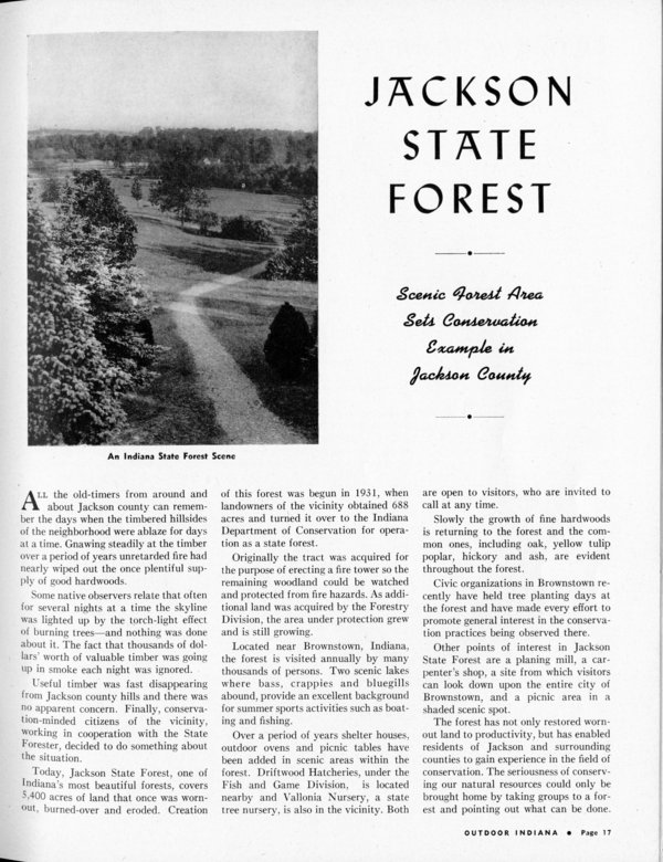
Above: This article states that Jackson State Forest was created in 1931. Quote: “Originally the tract was acquired for the purpose of erecting a fire tower”.
Above: A fun photo of the tower, whose source I cannot remember.
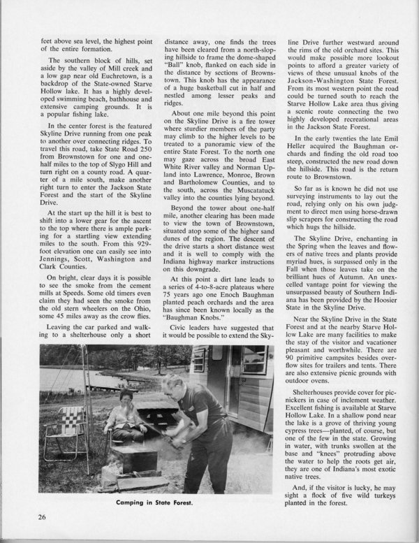
This June-July 1967 OI article describes Skyline Drive in detail and mentions the fire tower. Interestingly, the article states that people may climb the tower, suggesting that the tower is open to the public and is no longer being used for fire detection.
Personal photos