Information
Names: Wyandotte, O’Bannon Woods
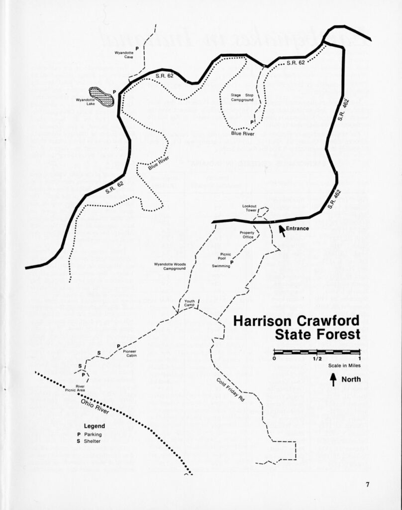
Location: O’Bannon Woods State Park (previously part of Harrison-Crawford State Forest)
County: Harrison (the only tower in this county)
Topo quad: Leavenworth
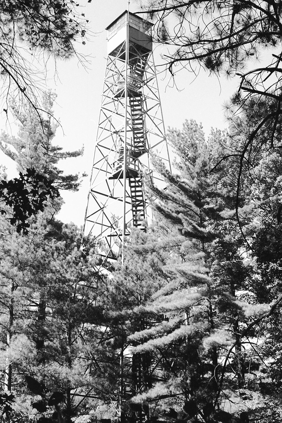
Condition: Standing; climbable up into cab. Great climb, great view.
Maps of Wyandotte tower
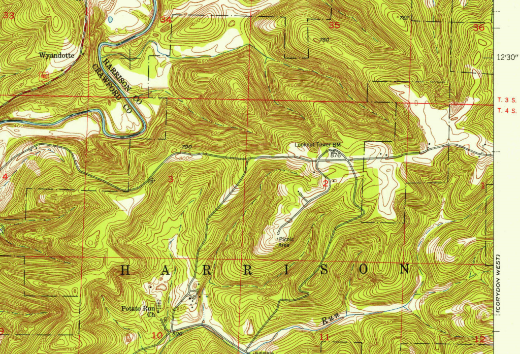
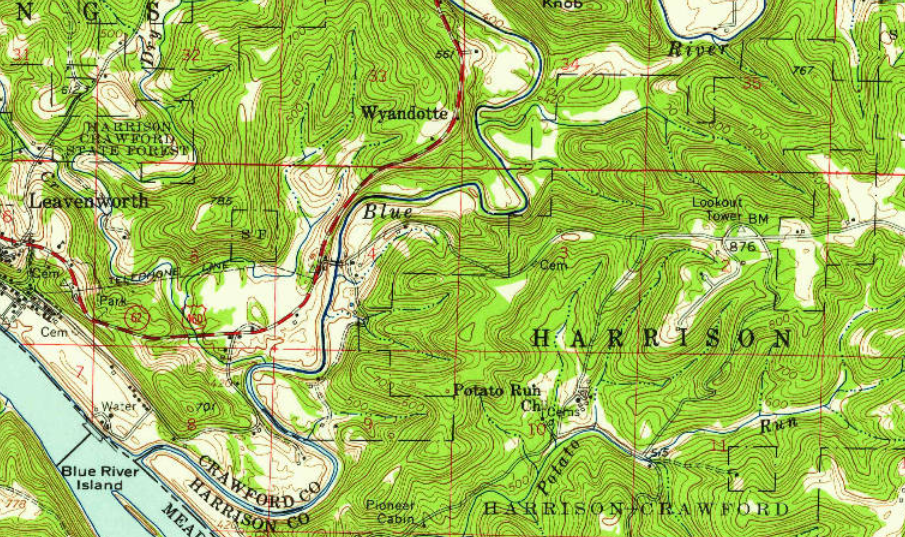
Note that the current roads around the tower may be different than they were in these 1950 maps.
Links
National Historic Lookout Register page for O’Bannon Woods tower
Living New Deal page for O’Bannon Woods State Park Fire Tower
National Geodetic Survey mark datasheet for LOOKOUT (JA0493)
Structural Survey numbers 004-348-06001, 061-348-25054
Data for Wyandotte tower
| Coordinates | Latitude | Longitude |
| My coordinates (unofficial) (Google Maps) | 38.19995 | -86.26832 |
| NHLR coordinates (Google Maps) | N 38° 11.997′ | W 086° 16.099′ |
| NGS datasheet (Google Maps) | 38 11 58.99702(N) | 086 16 05.52250(W) |
Personal photos of Wyandotte
History of Wyandotte tower
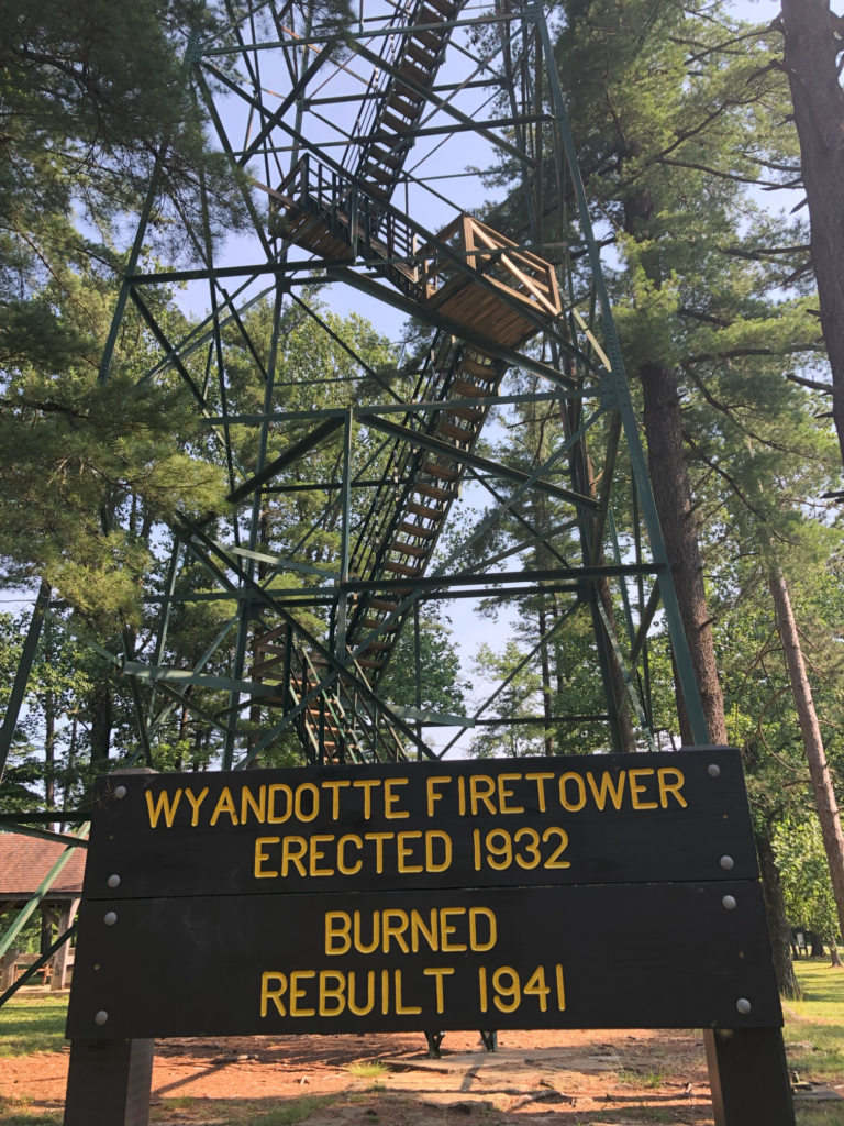
“Erected: 1932; Burned; Rebuilt 1941” — according to the sign at the tower.
A Facebook post by Indiana State Parks in September 2024 included a picture of the original wooden tower, saying it was built in 1933.
The survey 004-348-06001 page has this note, which comments on the sign: “-Sign below Tower: ‘Wyandotte Fire Tower/First Erected 1932/Rebuilt 1941’
*Despite the sign, the sources indicate the first tower, intended as temporary, was a fifty-five (55) foot wooden pole tower (not erected by the Civilian Conservation Corps – too early.) It was replaced by a one hundred (100) foot steel tower (erected by Civilian Conservation Corps) by 1937.”
The other survey has this note: “The fire tower at O’Bannon State Park was completed in 1937 by CCC laborers. The steel tower replaced a temporary, 55′ wooden tower.”
A May 1980 Outdoor Indiana article about “Wyandotte Woods” mentions work that was started in 1977, including: “The old gravel road around the Wyandotte firetower was asphalted and rerouted”.